Maximov A.P. Effusive eruptions of silicic magmas and mechanism of the deep degassing of aqueous magmas // IV International Biennial Workshop on Subduction Processes emphasizing the Japan-Kurile-Kamchatka-Aleutian Arcs. August 21-27, 2004, Petropavlovsk-Kamchatsky. 2004. P. 148-151.
McGimsey R.G., Neal C.A., Girina O.A. 1999 Volcanic Activity in Alaska and Kamchatka: Summary of Events and Response of The Alaska Volcano Observatory Open-File Report 2004-1033. 2004. 45 p.
McGimsey R.G., Neal C.A., Girina O.A. 2001 Volcanic Activity in Alaska and Kamchatka: Summary of Events and Response of the Alaska Volcano Observatory Open-File Report 2004-1453. 2004. 53 p.
Neal C.A., Girina O.A., Ferguson G., Osiensky J. AIRBORNE ASH HAZARD MITIGATION IN THE NORTH PACIFIC: A MULTI-AGENCY, INTERNATIONAL COLLABORATION // Proceedings of the 2nd International Conference on Volcanic Ash and Aviation Safety, June 21-24, 2004, Session 2. Alexandria, Virginia (USA): 2004. P. 55
Neal C.A., McGimsey R.G., Girina O.A. 2002 Volcanic Activity in Alaska and Kamchatka: Summary of Events and Response of the Alaska Volcano Observatory Open-File Report 2004-1058. 2004. 55 p.
Ozerov A.Yu. Evolution of basaltic melts within the feeding system of the Klyuchevskoy volcano // 32nd International Geological Congress. Florence, Italy. 2004, Abstracts. 2004. Vol. Part 1. P. 407
Pevzner M.M. New data on Holocene monogenetic volcanism of the Northern Kamchatka: ages and space distribution // Abstracts. 4rd Biennial Workshop on Subduction Processes emphasizing the Kurile-Kamchatka-Aleutian Arcs (JKASP-4). Linkages among tectonics, seismicity, magma genesis, and eruption in volcanic arcs. August 21-27, 2004. Petropavlovsk-Kamchatsky: Institute of Volcanology and Seismology FEB RAS. 2004. С. 72-76.
Pevzner M.M. The First Geological Data on the Chronology of Holocene Eruptive Activity in the Ichinskii Volcano (Sredinnyi Ridge, Kamchatka) // Doklady Earth Sciences. 2004. Vol. 395A. № 3. P. 335-337.
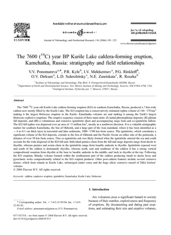
Ponomareva V.V., Kyle P.R., Melekestsev I.V., Rinkleff P.G., Dirksen O.V., Sulerzhitsky L.D., Zaretskaia N.E., Rourke R. The 7600 (14C) year BP Kurile Lake caldera-forming eruption, Kamchatka, Russia: stratigraphy and field relationships // Journal of Volcanology and Geothermal Research. 2004. Vol. 136. № 3-4. P. 199-222. doi:10.1016/j.jvolgeores.2004.05.013.
Аннотация
The 7600 14C-year-old Kurile Lake caldera-forming eruption (KO) in southern Kamchatka, Russia, produced a 7-km-wide caldera now mostly filled by the Kurile Lake. The KO eruption has a conservatively estimated tephra volume of 140–170 km3 making it the largest Holocene eruption in the Kurile–Kamchatka volcanic arc and ranking it among the Earth’s largest Holocene explosive eruptions. The eruptive sequence consists of three main units: (I) initial phreatoplinian deposits; (II) plinian fall deposits, and (III) a voluminous and extensive ignimbrite sheet and accompanying surge beds and co-ignimbrite fallout. The KO fall tephra was dispersed over an area of >3 million km2, mostly in a northwest direction. It is a valuable stratigraphic marker for southern Kamchatka, the Sea of Okhotsk, and a large part of the Asia mainland, where it has been identified as a f6 to 0.1 cm thick layer in terrestrial and lake sediments, 1000–1700 km from source. The ignimbrite, which constitutes a significant volume of the KO deposits, extends to the Sea of Okhotsk and the Pacific Ocean on either side of the peninsula, a distance of over 50 km from source. Fine co-ignimbrite ash was likely formed when the ignimbrite entered the sea and could account for the wide dispersal of the KO fall unit. Individual pumice clasts from the fall and surge deposits range from dacite to rhyolite, whereas pumice and scoria clasts in the ignimbrite range from basaltic andesite to rhyolite. Ignimbrite exposed west and south of the caldera is dominantly rhyolite, whereas north, east and southeast of the caldera it has a strong vertical compositional zonation from rhyolite at the base to basaltic andesite in the middle, and back to rhyolite at the top. Following the KO eruption, Iliinsky volcano formed within the northeastern part of the caldera producing basalt to dacite lavas and pyroclastic rocks compositionally related to the KO erupted products. Other post-caldera features include several extrusive domes, which form islands in Kurile Lake, submerged cinder cones and the huge silicic extrusive massif of Dikii Greben’ volcano.
Puzankov M.Yu., Bazanova L.I., Maximov A.P., Moskalyova S.V. The initial plinian basic andesite eruptions of the young cone, Avachinsky volcano (Kamchatka) // IV International Biennial Workshop on Subduction Processes emphasizing the Japan-Kurile-Kamchatka-Aleutian Arcs. August 21-27, 2004, Petropavlovsk-Kamchatsky. 2004. P. 158-160.