|
Records: 25
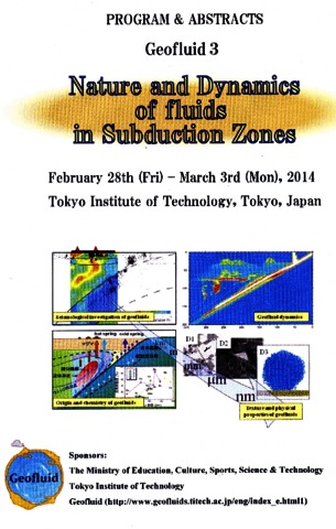
Churikova T., Gordeychik B., Wörner G. Mantle and fluid sources below Klyuchevskoy-Kamen-Bezymianny line (Kamchatka) / Geofluid-3. Nature and Dynamics of fluids in Subduction Zones. Tokyo, Japan, February 28 - March 3, 2014. Tokyo, Japan: Tokyo Institute of Technology. 2014. P. 72
Annotation
Kamen volcano is an extinct volcanic complex located in the central part of the Klyuchevskaya group of volcanoes (KGV) between active Klyuchevskoy, Bezymianny, and Ploskie Sopky volcanoes. Kamen volcano was mapped by V.A. Ermakov only in the 1970s. However the modern geochemical studies of Kamen volcano have not been previously carried out and its relationship and petrogenesis in comparison to other active neighbors are unknown. A modern geochemical study of Kamen volcano is needed because it will shed light not only on the history of the volcano itself and its closest neighbors, but also on the history and magmatic evolution of the KGV melts in general. The distance between the summits of Kamen and Klyuchevskoy is only 5 km, the same as between Kamen and Bezymianny. The close relationship in space and time of the KGV and the common zone of seismicity below them suggests a common source and a possible genetic relationship between their magmas. However, the Late-Pleistocene-Holocene lavas of all these neighboring volcanoes are very different: high-Mg and high-Al Ol-Cpx-Pl basalts and basaltic andesites occur at Klyuchevskoy volcano, and Hbl-bearing andesites and dаcites dominate at Bezymianny volcano. The rocks of Ploskie Sopky volcano, situated only 10 km NW of Kamen, are represented by medium-high-K subalkaline lavas.


|
Ditmar von Karl Reisen und Aufenthalt in Kamtschatka in den Jahren 1851–1855.
Erster Teil. Historischer Bericht nach den Tagebüchern. St. Petersburg: Buchdruckerei der Kaiserlichen Academie der Wissenschaften. 1890. 257 p.
Annotation
Der Geologe Karl von Ditmar erkundete von 1851 bis 1855 im Auftrag der russischen Regierung die Bodenschätze Kamčatkas. Dabei erforschte er das Land und seine Bevölkerung aber weit über diesen Autrag hinaus, was seine eindrucksvollen Reisebeschreibungen zeigen. So verbrachte er im Sommer 1853 als erster Forscher längere Zeit bei den Korjaken auf der Halbinsel Tajgonos. Der 1890 erschienene erste Teil seines Werkes enthält den ausführlichen Bericht seiner Reise nach den Tagebüchern, ein getrennt erscheinender zweiter Teil die systematische Darstellung der Natur und der Geschichte Kamčatkas.
|
Ditmar von Karl Reisen und Aufenthalt in Kamtschatka in den Jahren 1851–1855.
Zweiter Teil. Allgemeines über Kamtschatka. St. Petersburg: Buchdruckerei der Kaiserlichen Academie der Wissenschaften. 1900. 273 p.
Annotation
Der Geologe Karl von Ditmar erkundete von 1851 bis 1855 im Auftrag der russischen Regierung die Bodenschätze Kamčatkas. Dabei erforschte er das Land und seine Bevölkerung aber weit über diesen Autrag hinaus, was seine eindrucksvollen Reisebeschreibungen zeigen. So verbrachte er im Sommer 1853 als erster Forscher längere Zeit bei den Korjaken auf der Halbinsel Tajgonos. Der 1900 erschienene zweite Teil seines Werkes enthält die systematische Darstellung der Natur und der Geschichte Kamčatkas sowie ein geografisches Lexikon.
|
Flerov G.B., Churikova T.G., Anan'ev V.V. The Ploskie Sopki volcanic massif: Geology, petrochemistry, mineralogy, and petrogenesis (Klyuchevskoi Volcanic Cluster, Kamchatka) // Journal of Volcanology and Seismology. 2017. Vol. 11. Vol. 4. P. 266-284. doi: 10.1134/S0742046317040030.
Annotation
This paper is concerned with the geological history and petrology of a major polygenic volcanic edifice dating back to Upper Pleistocene to Holocene time. This long-lived volcanic center is remarkable in that it combines basaltic and trachybasaltic magmas which are found in basaltic andesite and trachybasaltic– trachyandesite series. The inference is that the coexisting parent magmas are genetically independent and are generated at different sources at depth in an upper mantle volume. The associated volcanic rocks have diverse compositions, stemming from a multi-stage spatio–temporal crystallization differentiation of the magmas and mixing of these in intermediate chas.
|
Ponomareva Vera, Portnyagin Maxim, Derkachev Alexander, Pendea I. Florin, Bourgeois Joanne, Reimer Paula J., Garbe-Schönberg Dieter, Krasheninnikov Stepan, Nürnberg Dirk Early Holocene M~6 explosive eruption from Plosky volcanic massif (Kamchatka) and its tephra as a link between terrestrial and marine paleoenvironmental records // International Journal of Earth Sciences. 2013. Vol. 102. № 6. P. 1673-1699. doi:10.1007/s00531-013-0898-0.
Annotation
We report tephrochronological and geochemical data on early Holocene activity from Plosky volcanic massif in the Kliuchevskoi volcanic group, Kamchatka Peninsula. Explosive activity of this volcano lasted for ~1.5 kyr, produced a series of widely dispersed tephra layers, and was followed by profuse low-viscosity lava flows. This eruptive episode started a major reorganization of the volcanic structures in the western part of the Kliuchevskoi volcanic group. An explosive eruption from Plosky (M~6), previously unstudied, produced tephra (coded PL2) of a volume of 10–12 km3 (11–13 Gt), being one of the largest Holocene explosive eruptions in Kamchatka. Characteristic diagnostic features of the PL2 tephra are predominantly vitric sponge-shaped fragments with rare phenocrysts and microlites of plagioclase, olivine and pyroxenes, medium- to high-K basaltic andesitic bulk composition, high-K, high-Al and high-P trachyandesitic glass composition with SiO2 = 57.5–59.5 wt%, K2O = 2.3–2.7 wt%, Al2O3 = 15.8–16.5 wt%, and P2O5 = 0.5–0.7 wt%. Other diagnostic features include a typical subduction-related pattern of incompatible elements, high concentrations of all REE (>10× mantle values), moderate enrichment in LREE (La/Yb ~ 5.3), and non-fractionated mantle-like pattern of LILE. Geochemical fingerprinting of the PL2 tephra with the help of EMP and LA-ICP-MS analyses allowed us to map its occurrence in terrestrial sections across Kamchatka and to identify this layer in Bering Sea sediment cores at a distance of >600 km from the source. New high-precision 14C dates suggest that the PL2 eruption occurred ~10,200 cal BP, which makes it a valuable isochrone for early Holocene climate fluctuations and permits direct links between terrestrial and marine paleoenvironmental records. The terrestrial and marine 14C dates related to the PL2 tephra have allowed us to estimate an early Holocene reservoir age for the western Bering Sea at 1,410 ± 64 14C years. Another important tephra from the early Holocene eruptive episode of Plosky volcano, coded PL1, was dated at 11,650 cal BP. This marker is the oldest geochemically characterized and dated tephra marker layer in Kamchatka to date and is an important local marker for the Younger Dryas—early Holocene transition. One more tephra from Plosky, coded PL3, can be used as a marker northeast of the source at a distance of ~110 km.

|
Гирина О.А. Ключевская группа вулканов с природным парком "Ключевской" // Особо охраняемые природные территории Камчатского края: опыт работы, проблемы управления и перспективы развития: доклады Второй региональной научно-практической конференции. Петропавловск-Камчатский: Камчатпресс. 2017. С. 68-71.
|
Гирина О.А. О некоторых особенностях тектоники Северной группы вулканов Камчатки // Геологические процессы в обстановках субдукции, коллизии и скольжения литосферных плит. Материалы Второй Всероссийской конференции с международным участием, Владивосток, 17–20 сентября 2014 г. Владивосток: Дальнаука. 2014. С. 30-32.
|
Гирина О.А. О развитии Северной группы вулканов Камчатки // VIII Международная научная конференция «Вулканизм, биосфера и экологические проблемы». Сборник материалов. Майкоп: Магарин О.Г.. 2016. С. 63-69.
|
Гирина О.А. Особенности тектоники Северной группы вулканов Камчатки // Материалы XVIII региональной научной конференции «Вулканизм и связанные с ним процессы», посвящённой Дню вулканолога, 30 марта - 1 апреля 2015 г. Петропавловск-Камчатский: ИВиС ДВО РАН. 2016. С. 26-31.
|
Гирина О.А. Спутниковые данные высокого разрешения для уточнения положения разломных зон в пределах Ключевской группы вулканов Камчатки // Современные проблемы дистанционного зондирования Земли из космоса. 2016. Т. 13. № 6. С. 148-156. https://doi.org/10.21046/2070-7401-2016-13-6-148-156.
Annotation
The Klyuchevskaya volcanic group of Kamchatka is unique in many respects: it includes 13 volcanoes, four of which are active; Klyuchevskoy volcano is the youngest and the most active of Kamchatka; the contrast (basaltic and andesitic) volcanism is observed within the relatively small area of this group. This work provides a general scheme of principal fault zones in the area of the Klyuchevskaya volcanic group superimposed on satellite data of middle and high resolution (MODIS, SRTM, ASTER, Landsat, Meteor-M, Kanopus-B and the others). The scheme of the fault zones was created on the basis of the analysis of a set of various published materials and numerous satellite data of different resolution, as well as on the author’s studies of the Klyuchevskaya group volcanoes. All faults at the scheme were well expressed in all examined satellite images. It is shown that the faults ever formed here are long-lived and their activity is associated with certain stages of the evolution of the Klyuchevskaya volcanic group. The formation of all volcanoes of this group mainly happens owing to faults of the northwest, northeast and west-northwest directions. For example, the current activity of Klyuchevskoy volcano is associated probably with the northwest and northeast striking faults; right-hand downthrow-upheaval movements along the faults of the north-northeast directions are likely to have led at different times to the collapse of the eastern parts of the volcanoes Ostry Tolbachik and Kamen.

|
|
|

|

|
|