Мархинин Е.К. Вулканизм как источник углерода в биосфере земли и процесс, питающий живое вещество // Вулканизм гидротермы и глубины земли (Материалы к 3-му Всесоюзному вулканологическому совещанию). Петропавловск-Камчатский: Дальневосточное книжное издательство. 1969. С. 72-73.
Мархинин Е.К. Вулканы и возникновение жизни в Солнечной системе // Сборник материалов Седьмой международной научной конференции "Вулканизм, биосфера и экологические проблемы". Майкоп-Туапсе: Адыгейский ГУ. 2013. С. 17-18.
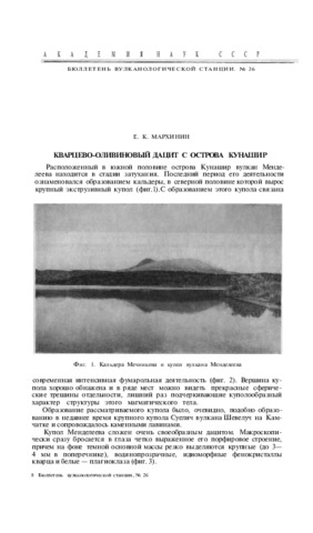
Мархинин Е.К. Вулканы острова Кунашир // Труды Лаборатории вулканологии АН СССР. 1959. Вып. 17. С. 64-155.
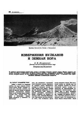
Мархинин Е.К. Извержения вулканов и земная кора // Природа. 1968. № 2. С. 26-33.
Аннотация
К проблеме происхождения земной коры, океана и атмосферы подходят с разных сторон. Немало вопросов уже решено геологами и геофизиками. Но многое остается неясным, недоказанным. Интересны исследования вулканолога, который считает, что вся геофизическая эволюция внешних оболочек Земли — в конечном счете преобразование первичных вулканических продуктов.
Мархинин Е.К. Истечение жидкой серы в кальдере Головнина летом 1979 года // Современный вулканизм и связанные с ним геологические, геофизические и геохимические явления (Тезисы докладов). Тбилиси: Мецниереба. 1980. С. 153-154.
Мархинин Е.К. История развития вулканизма на Курильских островах // Материалы к Первой Всесоюзной конференции по геологии и металлогении Тихоокеанского рудного пояса. Владивосток: Приморское кн. изд-во. 1960. Вып. 1. С. 114-115.