Егоров О.Н. Место вторичных кварцитов в ходе развития геосинклинали (на примере Юго-Восточной Камчатки) / Молодые гидротермально измененные породы и минералы Камчатки и Курильских островов. М.: Наука. 1969. С. 95-101.
Хубуная С.А., Ерёмина Т.С., Соболев А.В. Формационная принадлежность калиевых трахиандезибазальтов побочного извержения 2012–2013 гг. Вулкана Плоский Толбачик по геохимическим признакам (Камчатка) // Вулканология и сейсмология. 2016. № 1. С. 37-55.
Annotation
Abstract—This study is concerned with the petrographic, mineralogic, and geochemical features in the K-high basaltic trachyandesites that were discharged by the 2012–2013 parasitic eruption on Ploskii Tolbachik Volcano. These K-high basaltic trachyandesites exhibit some obvious characteristics that testify to their suprasubduction origin. They are deeply differentiated rocks with strongly fractionated plagioclase.A study of the Sr, Nd, and Pb radiogenic isotope ratios in the K-high basaltic trachyandesites provided evidence of their mantle origin and of the fact that the crust has exerted no influence on their compositions. We performed a comparative analysis of the ratios of the concentrations for some incoherent elements in the K-high basaltic trachyandesites, as well as in intraplate, riftogenic, and island-arc moderate potassium basalts and basaltic andesites in relation to the concentrations of these elements in the primitive mantle. The geochemical features of these K-high basaltic trachyandesites classify them as belonging to the suprasubduction subalkaline formation of the potassium series.
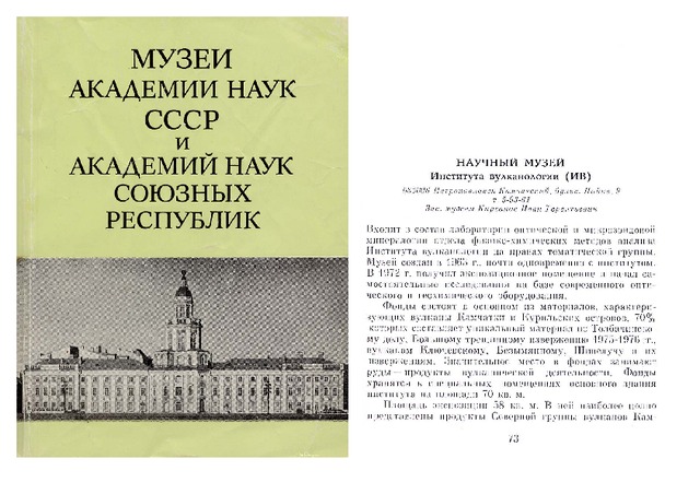
Кирсанов И.Т. Научный Музей института вулканологии (ИВ) / Музеи академии наук СССР и академий наук союзных республик. М.: Наука. 1989. С. 73-75.
Annotation
Настоящее издание - справочник-путеводитель. Он содержит сведения о музеях АН СССР и музеях академий наук союзных республик. В путеводителе рассказана краткая история их создания, дана характеристика экспозиций, структуры, фондов, отдельных уникальных коллекций и экспонатов.
Khubunaya S.A., Eremina T.S., Sobolev A.V. The classification of potassium basaltic trachyandesites that were discharged by the 2012–2013 parasitic eruption on Ploskii Tolbachik Volcano, Kamchatka using geochemical criteria // Journal of Volcanology and Seismology. 2016. Vol. 10. № 1. P. 33-49. doi: 10.1134/S0742046316010024.
Annotation
Изучены петрографические, минералогические и геохимические особенности К-трахиандезибазальтов побочного извержения 2012–2013 гг. вулкана Плоский Толбачик. К-трахиандезибазальты имеют явные признаки надсубдукционного происхождения. Это глубоко дифференцированные породы, характеризующиеся значительным фракционированием плагиоклаза. Изучение радиогенных изотопных отношений Sr, Nd и Pb в К-трахиандезибазальтах свидетельствует об их мантийном происхождении и отсутствии влияния земной коры на их составы. Проведен сравнительный анализ отношений содержаний некогерентых элементов в К-трахиандезибазальтов,внутриплитных,рифтогенных и островодужных умереннокалиевых базальтах и андезибазальтах к содержанию этих элементов в примитивной мантии. Геохимические особенности К-трахиандезибазальтов позволяют отнести их к надсубдукционной субщелочной формации калиевого ряда.
Копылова Г.Н., Болдина С.В. О связи изменений уровня воды в скважине E-1, Камчатка, с активизацией вулкана Корякский в 2008-2009 гг. и сильными (M ≥ 5) землетрясениями // Вулканология и сейсмология. 2012. № 5. С. 41-54.
Annotation
Abstract—We discuss the water!level variations in the E!1 well for the time period between May 2006 and
2010, inclusive. A trend towards an increasing level at an abnormally high rate occurred from mid!2006 to
December 2009. This increase is regarded as the response of the aquifer of gas!saturated ground water that
exists in the volcanogenic–sedimentary deposits of the Avacha volcano!tectonic depression to volumetric
strain changes during the precursory period and the occurrence of a swarm of small earthquakes ( = 8.3)
in the area of Koryakskii Volcano and to its phreatic eruption. We estimated the volumetric compression as
Δε = –(4.1 × 10⁻⁶–1.5 × 10⁻⁵) from the amplitude of water!level rise using the elastic parameters of the wa!
ter!saturated rocks. While the strain source was active, we observed a decreasing sensitivity of the hydrologic
regime in the well to the precursory processes before large (M ≥ 5.0) tectonic earthquakes.
Богатиков О.А., Хренов А.П., Ховавко С.А., Мальцев А.Л. Состав, структура и оценка количества аэрозолей в эксплозиях вулканов центрального типа (Камчатка) // Геология и геофизика. 1995. Т. 36. № 8. С. 111-116.
Богатиков О.А., Лексин А.Б., Маханова Т.М., Хренов А.П. Применение трехмерных цифровых моделей рельефа в вулканологии (по материалам радарных интерферометрических измерений) // Вулканология и сейсмология. 2005. № 4. С. 3-10.
Annotation
The construction of digital 3D models of volcanoes is now made much easier and faster after the JPL/NASA specialists have carried out an interferometer radar survey of the Earth's surface (SRTM - Shuttle Radar Topographic Mission). Computer processing of the interferometer measurements in the SIR-C/X-SAR wavelength range (L - 23 cm, С - 5.6 cm and X - 3.1 cm) enabled high accuracy to be attained in construction of 3D topographic models, marking more data on these in the geographic coordinate system, and continuing on this basis to develop "digital layers" with data from new eruptions plotted on them, resulting in quantitative estimation of erupted volumes in real time. This method also allows one to model possible locations of new eruptive centers based on fast seismological forecasts of eruptions in addition to predicting possible routes of new lava and pyroclastic flows, mud streams and labors, and assessing the range and geologic effects of an eruption, and its ecologic impact
Гонтовая Л.И., Хренов А.П., Степанова М.Ю., Сенюков С.Л. Глубинная модель литосферы в районе Ключевской группы вулканов (Камчатка) // Вулканология и сейсмология. 2004. № 3. С. 3-10.
Annotation
A velocity structure of the lithosphere has been determined in the junction area of the Kuril-Kamchatka and Aleutian island arcs based on travel times of compressional (P) and shear (S) waves excited by regional and volcanotectonic earthquakes using the algorithm of successive anomaly subtraction. We describe deep-seated velocity heterogeneities at different depths in the lithosphere, their relation to tectonics and to seismicity. It is shown that the deep-seated source of magma supply for the Klyuchevskoi volcanic cluster is confined to a junction of deep-seated mantle faults (in map view this occurs at the location where the Kamchatka R. streambed turns eastward). The heterogeneity in question probably has asthenospheric roots. The crustal velocity structure beneath Klyuchevskoi Volcano together with data provided by other geological and geophysical methods (deep seismic sounding, electromagnetic methods, lineament analysis etc.) provides an idea of the model and of a general view of the tectonomagmatic processes going on there.
Riley Colleen Origin of scatter in paleomagnetic directions of
samples from Gorely Volcano, Kamchatka, Russia. 1994. Дисс. докт. геол.-мин. наук. 70 p.
Annotation
Lava flows from sixteen sites at Gorely Volcano, Kamchatka were sampled. Initial analysis showed high within-site scatter for NRM specimen directions. Alternating field and thermal demagnetization of specimens showed single-component magnetization indicating that specimens had not moved or were not exposed to changes in the magnetic field during acquisition of a magnetic direction. Scatter is thought to be either due to movement of the specimen with respect to the magnetic field or change in the magnetic field with respect to the specimen. Four factors were found that would contribute to scatter in specimen directions. These are 1) cooling rate, 2) range of unblocking temperatures, 3) relative time of emplacement, and 4) how the specimen moved or was affected by changes in the magnetic field. Only two sites showed that scatter was due to movement of the specimen. It appears that scatter in other sites resulted from changes in the magnetic field generated from a magma-induced electrical current due to lava flowing in the earth’s magnetic field. These changes in the magnetic field are shown to have more affect on material sampled at the surface than on material sampled at depth because massive interiors of flows showed less dispersion in specimen directions than levees or pull-aparts.