Анализ извержений вулкана Безымянный в 2019 г. с помощью дистанционных методов исследований (2019)
Гирина О.А., Мельников Д.В., Маневич А.Г., Мальковский С.И., Сорокин А.А., Уваров И.А., Марченков В.В., Кашницкий А.В., Крамарева Л.С., Нуждаев А.А. Анализ извержений вулкана Безымянный в 2019 г. с помощью дистанционных методов исследований // Материалы 17-ой Всероссийской открытой конференции "Современные проблемы дистанционного зондирования Земли из космоса". М.: ИКИ РАН. 2019. https://doi.org/10.21046/17DZZconf-2019a
Анализ образующей вулканического конуса для выявления ослабленных секторов постройки (на примере Корякского вулкана, Камчатка) (2004)
Делемень И.Ф., Уткин И.С., Уткина Л.И., Мельников Д.В., Жданова О.К. Анализ образующей вулканического конуса для выявления ослабленных секторов постройки (на примере Корякского вулкана, Камчатка) // Вестник КРАУНЦ. Серия: Науки о Земле. 2004. № 4. С. 90-108.
Анализ подготовки Трещинного Толбачинского извержения 2012-2013 гг. в параметрах сейсмического режима и деформаций земной коры по данным системы комплексного мониторинга активности вулканов Камчатки (2015)
Кугаенко Ю.А., Титков Н.Н., Салтыков В.А., Воропаев П.В. Анализ подготовки Трещинного Толбачинского извержения 2012-2013 гг. в параметрах сейсмического режима и деформаций земной коры по данным системы комплексного мониторинга активности вулканов Камчатки // Вулканология и сейсмология. 2015. № 4. С. 40-58. https://doi.org/10.7868/S0203030615040057
Аннотация
Проанализированы смещения земной поверхности и сейсмичность перед Трещинным Толбачинским извержением, которое началось на Камчатке 27 ноября 2012 г. По сейсмическим и GPS данным выявлены синхронные предварявшие извержение аномалии деформаций земной коры и сейсмического режима длительностью около 4 месяцев (август-ноябрь 2012 г.). Сейсмическая аномалия представляет собой статистически значимую сейсмическую активизацию низкого энергетического уровня (преимущественно KS = 4-6) под постройкой вулкана Плоский Толбачик на глубине до 5 км. В последние 2-3 недели перед извержением среднемноголетние (2000-2011 гг.) скорости потока сейсмических событий и выделения сейсмической энергии были превышены ~ в 40 раз. Деформационные аномалии проявились в перемещении центральной части Ключевской группы вулканов: зарегистрировано сжатие в радиальном по отношению к извержению направлении и растяжение в тангенциальном. К началу извержения относительные деформации достигли ~ 10-7. Сопоставимая длительность сейсмической и деформационной аномалий (~ 4 месяца до извержения) свидетельствует об их общей генетической природе и позволяет отнести их к единому временному масштабу предвестников (согласно принятой терминологии – среднесрочному).
Анализ развития пароксизмального извержения вулкана Шивелуч 10–13 апреля 2023 года на основе данных различных спутниковых систем (2023)
Гирина О.А., Лупян Е.А., Хорват А., Мельников Д.В., Маневич А.Г., Нуждаев А.А., Бриль А.А., Озеров А.Ю., Крамарева Л.С., Сорокин А.А. Анализ развития пароксизмального извержения вулкана Шивелуч 10–13 апреля 2023 года на основе данных различных спутниковых систем // Современные проблемы дистанционного зондирования Земли из космоса. 2023. Т. 20. № 2. С. 283-291. https://doi.org/10.21046/2070-7401-2023-20-2-283-291
Аннотация
Шивелуч — наиболее активный вулкан Камчатки. Пароксизмальное эксплозивное извержение вулкана, разрушившее лавовый купол в кратере, происходило 10–13 апреля 2023 г. Согласно различным спутниковым данным, высота подъёма отдельных эруптивных облаков, вероятно, превышала 15 км над уровнем моря. Мощный циклон, во власти которого находился весь п-ов Камчатка, вытягивал эруптивное облако на запад, поворачивал его на юг, растягивал на север и направлял на восток от вулкана. Динамика развития пепловых и аэрозольных облаков этого извержения отражена на анимационных картинах, выполненных по сериям снимков спутника Himawari-9 в информационной системе «Дистанционный мониторинг активности вулканов Камчатки и Курил» (ИС VolSatView) с 08:00 UTC (англ. Coordinated Universal Time, всемирное координированное время) 10 апреля до 07:50 UTC 14 апреля (http://d33.infospace.ru/jr_d33/materials/2023v20n2/283-291/1683110898.webm) и данных спутника «Арктика-М» № 1 с 16:00 до 21:30 UTC 10 апреля (http://d33.infospace.ru/jr_d33/materials/2023v20n2/283-291/1683821166.webm). Отмечено, что эруптивная колонна во время извержения не была вертикальной: например, в начальный момент извержения 10 апреля в 13:20 UTC она отклонялась на северо-северо-восток, 11 апреля в 12:00 UTC — на северо-запад, 12 апреля в 07:00 UTC — на юго-запад. Во время пароксизмального извержения в атмосферу постоянно поступал диоксид серы, максимальное количество которого выделилось 10–11 апреля, связано это с эксплозивным разрушением лавового купола влк. Шивелуч. Пепловые облака вместе с аэрозольными 10–13 апреля были растянуты в полосу длиной более 3500 км с запада на северо-восток. 21–22 апреля аэрозольное облако Шивелуча отмечалось в районе Скандинавского п-ова. Общая площадь территории Камчатки и Тихого океана, на которой были зарегистрированы пепловые и аэрозольные шлейфы и облака в течение извержения 10–13 апреля, составляла около 3280 тыс. км2. Пароксизмальное извержение Шивелуча относится к субплинианскому типу, так как имеет высокие параметры подъёма пепловых облаков и продолжительности события. Для этого извержения VEI (англ. Volcanic Explosivity Index — вулканический эксплозивный индекс) оценивается как 3–4. Детальное описание пароксизмального эксплозивного извержения вулкана и распространения пеплового облака было выполнено на основании изучения данных различных спутниковых систем (Himawari-9, NOAA-18/19, GOES-18, Terra, Aqua, JPSS-1, Suomi NPP, «Арктика-М» № 1 и др.) в ИС VolSatView (http://kamchatka.volcanoes.smislab.ru).
Анализ событий эксплозивного извержения вулкана Безымянный 21 октября 2020 г. по спутниковым данным (2020)
Гирина О.А., Мельников Д.В., Маневич А.Г., Кашницкий А.В., Крамарева Л.С., Нуждаев А.А. Анализ событий эксплозивного извержения вулкана Безымянный 21 октября 2020 г. по спутниковым данным // Современные проблемы дистанционного зондирования Земли из космоса. 2020. Вып. 17. № 5. С. 297-303. https://doi.org/10.21046/2070-7401-2020-17-5-297-303
Аннотация
Вулкан Безымянный — один из наиболее активных вулканов Камчатки и мира. Предыдущее его извержение произошло 15 марта 2019 г. В настоящей работе описано эксплозивное извержение вулкана 21 октября 2020 г. и предваряющие его события на основании изучения видеоматериалов и различных спутниковых данных. Спутниковый мониторинг вулкана проводился с помощью информационной системы «Дистанционный мониторинг активности вулканов Камчатки и Курил» (VolSatView) с 2014 г. Эксплозии подняли пепел до 10–11 км над уровнем моря, в связи с циклоном в районе Камчатки эруптивное облако было разделено на две части: северная часть в течение 21–23 октября находилась над Ключевской группой вулканов, южная переместилась на расстояние более 1000 км на юго-восток от вулкана. Основная площадь территории, на которой отмечались пеплопады, на 10:11 GMT 22 октября 2020 г. составила около 111,5 тыс. км2, в том числе на суше — 60,8 тыс. км2. Показано анимированное изображение движения пеплового облака от вулкана, выполненное по серии снимков Himawari-8 в VolSatView (http://kamchatka.volcanoes.smislab.ru/animation/1603972936.webm). Для этого извержения VEI равен 2.
Анализ эксплозивных извержений вулканов Камчатки и Курил с помощью информационных технологий (2019)
Гирина О.А., Романова И.М., Мельников Д.В., Маневич А.Г., Лупян Е.А., Сорокин А.А., Крамарева Л.С., Уваров И.А., Кашницкий А.В., Константинова А.М., Мальковский С.И., Королев С.П. Анализ эксплозивных извержений вулканов Камчатки и Курил с помощью информационных технологий // Информационные технологии и высокопроизводительные вычисления. Материалы V Международной научно-практической конференции. Хабаровск, 16-19 сентября 2019 г. Хабаровск: Тихоокеанский государственный университет. 2019. С. 18-23.
Аннотация
Ежедневный мониторинг вулканов Камчатки выполняется с 1993 г., Курил - с 2003 г. С 2009 г. с применением современных информационных технологий и методов развиваются информационные системы, оснащенные современными инструментами для анализа данных, с помощью которых в ИВиС ДВО РАН выполняются комплексные исследования вулканогенных процессов Курило-Камчатского региона, в том числе наиболее опасных для человека эксплозивных извержений, а также продуктов извержений вулканов. Созданные системы позволяют вулканологам работать с различными спутниковыми данными совместно с метео- и видеоинформацией для непрерывного мониторинга и исследования вулканической активности; моделировать распространение пепловых облаков и шлейфов для оценки их опасности для авиации; объединять и систематизировать различную информацию о вулканах и их извержениях.
Андезитобазальты инициальных плинианских извержений молодого конуса Авачинского вулкана (Камчатка) (2004)
Пузанков М.Ю., Базанова Л.И., Максимов А.П., Москалева С.В. Андезитобазальты инициальных плинианских извержений молодого конуса Авачинского вулкана (Камчатка) // Взаимосвязь между тектоникой, сейсмичностью, магмообразованием и извержениями вулканов в вулканических дугах. Материалы IV Международного совещания по процессам в зонах субдукции Японской, Курило-Камчатской и Алеутской островных дуг. Петропавловск-Камчатский: ИВиС ДВО РАН. 2004. С. 158-160.
Иванов Б.В. Андезитовый вулканизм Тихоокеанского подвижного пояса (ТПП) // Вулканизм и геодинамика. Материалы II Всероссийского симпозиума по вулканологии и палеовулканологии, г. Екатеринбург, 2003 г. Екатеринбург: 2003. С. 184-191.
Андезиты Камчатки (справочник химических анализов вулканитов и основных породообразующих минералов) (2008)
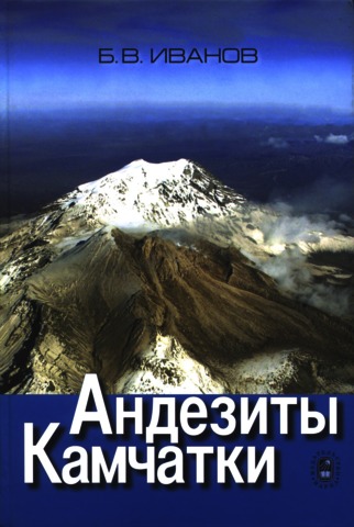
Иванов Б.В. Андезиты Камчатки (справочник химических анализов вулканитов и основных породообразующих минералов) / Отв. ред. Колосков А.В. М.: Наука. 2008. 364 с.
Аннотация
Впервые приводятся наиболее полные данные по химическому составу четвертичных андезитов Камчатки. Помимо химического состава андезитов дается их фазовый анализ, геохимический состав, содержание РЗЭ, изотопный анализ стронция, неодима, кислорода. Главной особенностью опубликованных анализов является их стратификация и четкая геологическая привязка образцов, что позволяет понимать последовательность геологических событий. Рассматриваются петрогенетические особенности толеитовых (андезитов мантийного генезиса I типа) и известково-щелочных (андезитов мантийно-корового генезиса II типа) андезитов. Подчеркивается значение петрохимических, петрологических и изотопно-геохимических корреляторов для распознания двух типов андезитов. На основе петрохимической базы данных выделяется устойчивый, неустойчивый и промежуточный тренды дифференциации вулканитов, которые предлагается использовать для определения характера вулканической деятельности и типов вулканических извержений.
Книга может быть использована как справочник по андезитовому вулканизму и рассчитана на вулканологов, петрографов, геохимиков и геологов, занимающихся вопросами происхождения вулканических пород.