|
Записей: 368
Гирина О.А., Коновалова О.А., Маневич А.Г., Мельников Д.В., Нуждаев А.А., Ушаков С.В., Демянчук Ю.В. Активность вулканов Камчатки в 2009 г. // Материалы конференции, посвященной Дню вулканолога «Современный вулканизм и связанные с ним процессы», Петропавловск-Камчатский, 29-30 марта 2010 г. Петропавловск-Камчатский: ИВиС ДВО РАН. 2011. С. 41-49.
|
Гирина О.А., Крамарева Л.С., Лупян Е.А., Мельников Д.В., Маневич А.Г., Сорокин А.А., Уваров И.А., Кашницкий А.В., Бурцев М.А., Марченков В.В., Бриль А.А., Мазуров А.А., Романова И.М., Мальковский С.И. Применение данных спутника Himawari для мониторинга вулканов Камчатки // Современные проблемы дистанционного зондирования Земли из космоса. 2017. Т. 14. № 7. С. 65-76. https://doi.org/10.21046/2070-7401-2017-14-7-65-76.
Аннотация
Действующие вулканы Камчатки ― одни из самых активных в мире. Ежегодно здесь происходят извержения 3−7 вулканов, во время которых эксплозии поднимают пепел до 10−15 км над уровнем моря и пепловые облака распространяются на тысячи километров от вулканов. Активная вулканическая деятельность может стать причиной пеплопадов в городах и поселках, уничтожения лесов и коммуникаций. Пепловые облака и шлейфы представляют серьезную опасность для полетов современной реактивной авиации. Для снижения вулканоопасности для авиаперевозок и населения с 1993 г. Камчатская группа реагирования на вулканические извержения (KVERT) выполняет ежедневный мониторинг вулканов. С 2014 г. спутниковый мониторинг вулканов проводится учеными KVERT с помощью информационной системы VolSatView, в которую с 2016 г. начали поступать данные с геостационарного спутника Himawari-8. В системе созданы специальные инструменты, позволяющие работать с оперативно поступающими данными и анализировать ряды долговременных наблюдений. Применение данных Himawari-8, а также инструментов, реализованных в VolSatView для работы с ними, позволяет: значительно повысить оперативность обнаружения эксплозивных событий, происходящих в регионе; определять начало эруптивных событий с точностью до 10 и менее минут; отслеживать и прогнозировать все изменения динамики активности вулканов, в том числе близкое начало сильных эксплозивных событий. Статья посвящена описанию особенностей технологии интеграции данных Himawari-8 в VolSatView и основным возможностям работы с ними, реализованным в настоящее время в системе.


|
Гирина О.А., Крамарева Л.С., Лупян Е.А., Сорокин А.А., Мельников Д.В., Маневич А.Г., Уваров И.А., Кашницкий А.В., Бурцев М.А., Марченков В.В., Бриль А.А., Мазуров А.А. Применение данных со спутника Himawari-8 для мониторинга вулканов Камчатки и Северных Курил // Современные проблемы дистанционного зондирования Земли из космоса. Тезисы докладов. Пятнадцатая Всероссийская открытая конференция. 13-17 ноября 2017 г. М.: ИКИ РАН. 2017. С. 82
|
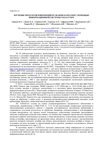
Гирина О.А., Лупян Е.А. , Гордеев Е.И., Сорокин А.А., Ефремов В.Ю., Кашницкий А.В., Уваров И.А., Крамарева Л.С., Мельников Д.В., Маневич А.Г. Изучение продуктов извержений вулканов Камчатки с помощью информационной системы VolSatView // Материалы Пятой научно-технической конференции Проблемы комплексного геофизического мониторинга Дальнего Востока России, 27 сентября - 3 октября 2015 г. , г. Петропавловск-Камчатский. Петропавловск-Камчатский: 2015.
Аннотация
Созданная в 2010 г. совместными усилиями специалистов ИВиС ДВО РАН, ИКИ РАН, ВЦ ДВО РАН и ДЦ ФГУП НИЦ Планета информационная система «Мониторинг активности вулканов Камчатки и Курил» (VolSatView, http://volcanoes.smislab.ru), продолжает развиваться и сегодня позволяет работать с различными спутниковыми данными среднего и высокого разрешения, метео- и инструментальной информацией наземных сетей наблюдений, проводить совместный анализ различных данных.
|
Гирина О.А., Лупян Е.А. , Гордеев Е.И., Сорокин А.А., Ефремов В.Ю., Кашницкий А.В., Уваров И.А., Крамарева Л.С., Мельников Д.В., Маневич А.Г., Романова И.М., Королев С.П. Изучение продуктов извержений вулканов Камчатки с помощью информационной системы VolSatView // Тринадцатая Всероссийская открытая конференция "Современные проблемы дистанционного зондирования Земли из космоса". 2015.
|
Гирина О.А., Лупян Е.А., Гордеев Е.И., Сорокин А.А., Крамарева Л.С., Мельников Д.В., Маневич А.Г., Уваров И.А., Кашницкий А.В., Романова И.М., Константинова А.М., Королев С.П. Информационная система VolSatView для комплексного анализа активности вулканов Камчатки и Курил // Информационные технологии и высокопроизводительные вычисления. Материалы IV Всероссийской научно-практической конференции, 11-14 сентября 2017 г. Хабаровск: ТГУ. 2017. С. 36-39.
Аннотация
В 2011-2017 гг. специалистами ИВиС ДВО РАН, ИКИ РАН, ВЦ ДВО РАН и ДЦ НИЦ Планета была создана и развивается информационная система “Дистанционный мониторинг активности вулканов Камчатки и Курил” (VolSatView), позволяющая вулканологам комплексно работать с различными спутниковыми данными, метео- и видеоинформацией для непрерывного мониторинга и исследования вулканической активности Курило-Камчатского региона. В работе показаны возможности VolSatView для оперативного мониторинга вулканов, анализа динамики извержений и их продуктов, прогноза эруптивной деятельности.

|
Гирина О.А., Лупян Е.А., Крамарева Л.С., Мельников Д.В., Маневич А.Г., Сорокин А.А., Гордеев Е.И., Уваров И.А., Кашницкий А.В., Бурцев М.А., Марченков В.В., Мазуров А.А., Константинова А.М., Романова И.М., Мальковский С.И., Королев С.П. Информационная система Дистанционный мониторинг активности вулканов Камчатки и Курил (ИС VolSatView): возможности и опыт работы // Шестнадцатая Всероссийская Открытая конференция «Современные проблемы дистанционного зондирования Земли из космоса». М.: ИКИ РАН. 2018. С. 5
|
Гирина О.А., Лупян Е.А., Мельников Д.В., Маневич А.Г., Кашницкий А.В., Бриль А.А., Сорокин А.А. Извержения Северной группы вулканов Камчатки 14–18 июня 2017 года // Современные проблемы дистанционного зондирования Земли из космоса. 2017. Т. 14. № 3. С. 317-323. https://doi.org/10.21046/2070-7401-2017-14-3-317-323.
Аннотация
14–18 июня 2017 г. произошли эксплозивные извержения трёх вулканов Северной группы Камчатки: шесть Шивелуча – два мощных и четыре умеренной силы; непрерывное Ключевского и одно мощное Безымянного. Наиболее полная информация об этих извержениях была получена при анализе спутниковых данных в информационной системе «Дистанционный мониторинг активности вулканов Камчатки и Курил» (VolSatView, http://volcanoes.smislab.ru). Благодаря информации со спутника Himawari-8 удалось восстановить развитие всех происходивших в районе вулканов событий: начала их эксплозий и пеплопадов в посёлках, размеры пепловых облаков, направления их перемещения и др. Например, в результате этих извержений пепловые облака переместились на более чем 4500 км на юго-восток от вулканов, отложения пеплов покрыли территорию Камчатки площадью около 47 800 км2. Кроме этого, по данным со спутника Himawari-8 создана анимационная картина эксплозивных событий 14–18 июня 2017 г., наглядно иллюстрирующая скоротечность мощных эксплозивных извержений и долговременность существования в атмосфере пепловых облаков, представляющих реальную опасность для авиатранспорта: http://kamchatka.volcanoes.smislab.ru/animation/sample.gif

|
Гирина О.А., Лупян Е.А., Мельников Д.В., Маневич А.Г., Нуждаев А.А., Бриль А.А., Озеров А.Ю., Крамарева Л.С., Сорокин А.А., Королев С.П. Мониторинг пароксизмального извержения вулкана Шивелуч 10-13 апреля 2023 г. дистанционными методами // Материалы 21-й Международной конференции "Современные проблемы дистанционного зондирования Земли из космоса". М.: ИКИ РАН. 2023. № XXI.B.446. https://doi.org/10.21046/21DZZconf-2023a.
Аннотация
|
Гирина О.А., Лупян Е.А., Сорокин А.А., Крамарева Л.С. Вулканы и космос // Земля и Вселенная. 2022. № 5. С. 5-18. https://doi.org/10.7868/S0044394822050012.
Аннотация
Вулканы – грандиозные создания Природы, никогда не оставляющие равнодушным человечество. Они существуют на всех планетах Солнечной системы. Возможно, именно благодаря вулканам появилась жизнь на планете Земля. Для одних вулканы – страх и ужас, для других – бесконечный восторг... Изучению вулканов на планете Земля наземными и космическими методами и необходимости ведения таких исследований посвящена эта статья.
|
|