|
Records: 68
Гирина О.А. Спутниковые данные высокого разрешения для уточнения положения разломных зон в пределах Ключевской группы вулканов Камчатки // Современные проблемы дистанционного зондирования Земли из космоса. 2016. Т. 13. № 6. С. 148-156. https://doi.org/10.21046/2070-7401-2016-13-6-148-156.
Annotation
The Klyuchevskaya volcanic group of Kamchatka is unique in many respects: it includes 13 volcanoes, four of which are active; Klyuchevskoy volcano is the youngest and the most active of Kamchatka; the contrast (basaltic and andesitic) volcanism is observed within the relatively small area of this group. This work provides a general scheme of principal fault zones in the area of the Klyuchevskaya volcanic group superimposed on satellite data of middle and high resolution (MODIS, SRTM, ASTER, Landsat, Meteor-M, Kanopus-B and the others). The scheme of the fault zones was created on the basis of the analysis of a set of various published materials and numerous satellite data of different resolution, as well as on the author’s studies of the Klyuchevskaya group volcanoes. All faults at the scheme were well expressed in all examined satellite images. It is shown that the faults ever formed here are long-lived and their activity is associated with certain stages of the evolution of the Klyuchevskaya volcanic group. The formation of all volcanoes of this group mainly happens owing to faults of the northwest, northeast and west-northwest directions. For example, the current activity of Klyuchevskoy volcano is associated probably with the northwest and northeast striking faults; right-hand downthrow-upheaval movements along the faults of the north-northeast directions are likely to have led at different times to the collapse of the eastern parts of the volcanoes Ostry Tolbachik and Kamen.


|
Гирина О.А., Лупян Е.А., Сорокин А.А., Мельников Д.В., Романова И.М., Кашницкий А.В., Уваров И.А., Мальковский С.И., Королев С.П., Маневич А.Г., Крамарева Л.С. Комплексный мониторинг эксплозивных извержений вулканов Камчатки / Отв. ред. Гирина О.А. Петропавловск-Камчатский: ИВиС ДВО РАН. 2018. 192 с.
Annotation
The monograph presents various data about the volcanoes of Kamchatka and describes the possibilities of studying them based on the integrated use of remote sensing, ground-based observation and numerical simulation methods and technologies. Considerable attention is paid to the construction and application of the information systems that today provide operational monitoring and studies of volcanic activity, which have been jointly developed in the recent years by the experts from the Institute of Volcanology and Seismology of the Far East Branch of the Russian Academy of Sciences (IVS FEB RAS) (Petropavlovsk-Kamchatsky), Space Research Institute RAS (Moscow), Computing Center FEB RAS (Khabarovsk) and the Far East Branch of the Research Center “Planetа” (Khabarovsk). The results of complex studies of explosive volcanic eruptions and the potential hazards of the Kamchatkan active volcanoes to the population and aviation are presented which are obtained by the scientists of IVS FEB RAS, particularly exploring the new methods, technologies and systems described in the monograph.

|
Гирина О.А., Чернягина О.А., Ненашева Е.М. Ключевская группа вулканов - уникальный природный объект Камчатки // Знание беспредельно ... Материалы XXXV Крашенинниковских чтений. Петропавловск-Камчатский: ККНБ им. С.П. Крашенинникова. 2018. С. 242-247.
|
Горшков Г.С. Состояние вулканов Северной Камчатки в 1956 г. // Бюллетень вулканологических станций. 1958. № 27. С. 3-15.
|
Гущенко И.И. Извержения вулканов мира. Каталог / Отв. ред. Рудич К.Н. М.: Наука. 1979. 476 с.
|
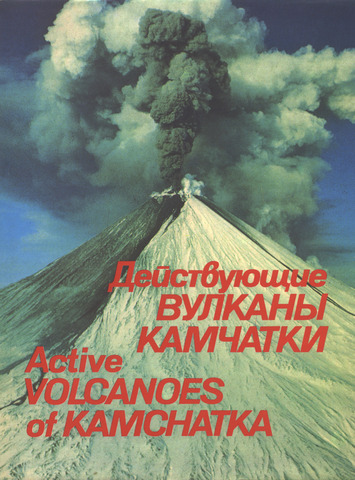
Действующие вулканы Камчатки. В 2-х т. Т. 1 / Отв. ред. Федотов С.А., Масуренков Ю.П. М.: Наука. 1991. 302 с.
Annotation
The book provides a systematic description of active volcanoes of Kamchatka — one of the most active volcanic regions of the world. Distribution, shape and activity of the volcanoes, their position in complex and long-lived volcanic centres, as well as their geologic structure and composition are presented.
The book is illustrated with colour maps, schemes, and sketches. Over 300 colour photographs show volcanic landscapes, diverse volcanic forms (cones, craters, lava flows, calderas, etc.) and various manifestations of post-volcanic activity (hydrotherms, famous Kamchatka geysers).
Concise, lavishly illustrated with colourful and high-quality photographs, the book makes an interesting and useful reading not only for specialists (volcanologists, geologists, geochemists, geophysicists, geographes, etc.) but for a bioad readership as well. The publication is unique and unparalleled in scientific literature. The text is presented in Russian and in English.
This monography is written by scientists from the Institute of volcanology, Far East Division, the Academy of Science of the USSR.

|
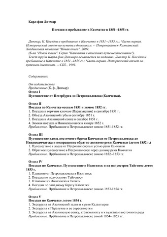
Дитмар К.В. Поездки и пребывание в Камчатке в 1851–1855 гг. / Отв. ред. Мелекесцев И.В. Петропавловск-Камчатский: Холд. комп-я "Новая книга". 2009. 579 с.
Annotation
Данная книга — первое переиздание выпущенного в Санкт-Петербурге Российской Императорской академией наук в 1901 году научного труда известного исследователя Камчатки середины XIX века Карла фон Дитмара.
К книге прилагается "Карта Камчатки, пополненная по дневникам своих путешествий К. Дитмаром, 1889". На вклейках — иллюстрации из издания 1901 года: рисунки "Вид Авачинской губы с Петропавловском и Корякской сопкой", "Вид Петропавловска. Середина XIX века", "Порт Петра и Павла. Старинная гравюра" и "Геологическая карта Авачинской губы".
Текст сопровождается иллюстрациями: схематическими рисунками и картосхемами (планами).
Авт. ст. от изд-ва Е.В. Гропянов ; рецензент и науч. ред. И.В. Мелекесцев ; авт. предисл. к камч. изданию И.В. Мелекесцев. — [Переизд. по: Дитмар К. Поездки и пребывание в Камчатке в 1851–1855 гг. — Ч. 1 : Исторический отчет по путевым дневникам. — СПб., 1901].

|
Дитмар К.В. Поездки и пребывание в Камчатке в 1851–1855 гг. Ч. 1. Исторический отчет по путевым дневникам. СПб.: Имп. Академия наук. 1901. 756 с.
|
Ермаков В.А. Некоторые вопросы методики картирования вулканогенных формаций на примере Ключевской группы вулканов на Камчатке / Методика картирования вулканических формаций. М.: Наука. 1969. С. 62-73.
|
Ермаков В.А. Формационное расчленение четвертичных вулканических пород. Москва: Недра. 1977. 223 с.
Annotation
В книге приводится систематическое описание вулканов Ключевской группы (на Камчатке): их геологическое строение, петрология и эволюция, а также геолого-петрографические схемы района в целом и отдельных вулканов. На тектонической основе проведено расчленение пород на две формации: базальт-андезито-базальтовую и базальт-андезито-дацитовую, которые отличаются по вещественному составу пород, набору включений, тектоническим условиям проявления и связи с различными зонами генерации магмы. С использованием сейсмологических данных и ГСЗ показано, что источники магмы пород первой формации располагаются в верхней мантии, а второй формации — в земной коре. Предложена единая схема тектоно-магматического процесса, в котором извержения базальтов связываются с растяжениями и оживлением глубинного разлома, а чередующиеся с ними извержения пород среднего состава — с эпохами сжатия, вертикальными движениями и палингенезом в земной коре.
|
|