Горбач Н.В., Гирина О.А. Особенности химического состава продуктов извержения вулкана Безымянный в марте 2019 г. // Вулканизм и связанные с ним процессы. Материалы XXIII ежегодной научной конференции, посвящённой Дню вулканолога. Петропавловск-Камчатский: ИВиС ДВО РАН. 2020. С. 15-17.
Калачева Е.Г. Экспедиционные исследования Курильских островов в 2020 г. // Вестник КРАУНЦ. Серия: Науки о Земле. 2020. Вып. 48. № 4. С. 101-107. doi: 10.31431/1816-5524-2020-4-48-101-107.
Аннотация
В данном сообщении приводится краткая характеристика экспедиционных работ на Курильских островах, выполненных в рамках темы НИР, проектов РНФ и РФФИ, реализующихся в лаборатории постмагматических процессов Института вулканологии и сейсмологии ДВО РАН. С целью изучения химической эрозии вулканических островов и для оценки гидротермального выноса магматических летучих, проведены гидрологические и гидрохимические работы на реках, дренирующих склоны и термальные поля вулканических массивов Синарка, Кунтоминтар (о. Шиашкотан), хребтов Вернадского и Карпинского (о. Парамушир). Выполнена инфракрасная съемка, измерен общий поток вулканического SO2 и диффузионный поток СО2 на термальных полях в кальдере вулкана Головнина. Для изучения взаимосвязи вулканической и гидротермальной деятельности вулкана Эбеко, сделана детальная гидрогеохимическая съемка на его термальных полях. Для дальнейших аналитических исследований в ходе экспедиционных работ отобрано большое число водных и газовых проб, собрана представительная коллекция пород и осадков.
Колосков А.В. Изотопно-геохимическая неоднородность плиоцен-четвертичных вулканитов Камчатки и проблема астеносферного диапиризма // Вестник КРАУНЦ. Серия: Науки о Земле. 2020. Вып. 47. № 3. С. 25-57. doi: 10.31431/1816-5524-2020-47-3-25-57.
Аннотация
Проведено обобщения изотопно-геохимического материала для плиоцен-четвертичных вулканитов Камчатского региона на картографической основе. Отмечена пространственная сопряженность Sr-изотопных аномалий умеренной и повышенной радиогенности и их хорошее геохимическое подтверждение. Что дало возможность интерпретировать эти аномалии не только как отражение в составе вулканических пород материала мантийного плюма, но и его гибридного окружения, как следствие плюм-литосферной ремобилизации. Наличие разнонаправленных геохимических трендов позволило предложить концепцию скользящих граничных значений для составов индикаторных пород внутриплитного типа и адакитов, что существенно расширило возможности их диагностики. Изотопно-геохимическая неоднородность базальтоидов региона определяется в целом особенностями концентрации пород с внутриплитными и адакитовыми геохимическими характеристиками, что позволяет считать астеносферный диапиризм основным фактором петрогенезиса плиоцен-четвертичного вулканизма Камчатки.
Копылова Г.Н., Болдина С.В., Чубарова Е.Г. Проявление активизаций вулканов Авачинской группы в изменениях уровня воды в скважине Е-1 // Вулканизм и связанные с ним процессы. Материалы XXIII ежегодной научной конференции, посвящённой Дню вулканолога. Петропавловск-Камчатский: ИВиС ДВО РАН. 2020. С. 99-102.
Малик Н.А., Некрасова М.Ю. Комплексные исследования активности Авачинского вулкана в 2013–начале 2020 гг.: наземные, видео и сейсмические наблюдения // Вестник КРАУНЦ. Серия: Науки о Земле. 2020. Вып. 46. № 2. С. 41-54. doi: 10.31431/1816-5524-2020-2-46-41-54.
Аннотация
Приведены результаты режимных наблюдений на высокотемпературных фумарольных полях (Восточном и Западном) вулкана Авачинский в 2013–2020 гг., включающих визуальное обследование, измерение температуры, отбор газа, дополненных данными видеонаблюдений. С целью выявления связи между фумарольной активностью и глубинными процессами был проведен анализ сейсмичности района вулкана за указанный период. Было выделено два периода повышенной сейсмической активности. Первый, в ноябре 2014 г. – январе 2015 г., по времени связан с изменениями характера истечения газа, морфологии и температуры Западной фумаролы, отмеченными при полевых наблюдениях, отразившимися на соотношении расходов газа двух высокотемпературных фумарольных полей. Второй, в октябре – декабре 2019 г., сопровождался в темное время суток свечением, временами — яркими вспышками, в районе Западной фумаролы, а в результате наземного обследования в 2020 г. были выявлены дальнейшие изменение ее морфологии.
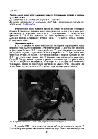
Мельников Д.В., Ушаков С.В., Гирина О.А., Маневич А.Г. Формирование новых озёр в Активной воронке Мутновского вулкана и кратере вулкана Райкоке // Вулканизм и связанные с ним процессы. Материалы XXIII ежегодной научной конференции, посвящённой Дню вулканолога. Петропавловск-Камчатский: ИВиС ДВО РАН. 2020. С. 42-44.
Озеров А.Ю., Гирина О.А., Жаринов Н.А., Белоусов А.Б., Демянчук Ю.В. Извержения вулканов Северной группы Камчатки в начале XXІ века // Вулканология и сейсмология. 2020. № 1. С. 3-19. https://doi.org/10.31857/S0203030620010058.
Аннотация
В начале XXІ в. наблюдается повышенная эруптивная активность крупнейших вулканов Северной группы Камчатки: Шивелуч, Ключевской, Безымянный и Толбачинской трещинной зоны. Отмечаются особенности роста экструзивного купола андезитового вулкана Шивелуч: за 38 лет почти непрерывной эруптивной деятельности высота купола достигла 600 м. После восьмилетнего периода относительного покоя произошло девять вершинных извержений и два боковых прорыва базальтового вулкана Ключевской. Почти ежегодно наблюдались эксплозивно-эффузивные извержения андезитового вулкана Безымянный. После 36 лет покоя в районе Толбачинской региональной трещинной зоны произошло новое извержение.
Рашидов В.А., Аникин Л.П. Полевые работы на вулкане Алаид (о. Атласова, Курильские острова) в 2020 году // Вестник КРАУНЦ. Серия: Науки о Земле. 2020. Вып. 47. № 3. С. 112-119. doi: 10.31431/1816-5524-2020-47-3-112-119.
Аннотация
Полевые работы на вулкане Алаид, расположенном на острове Атласова в Курильской островной дуге, в 2020 г. были проведены в прибрежной зоне на участке от мыса Девятка до мыса Кудрявого, а базовый лагерь находился на месте бывшей рыболовной базы Девятка. Во время исследований вулкан Алаид находился в стадии фумарольной активности. В ходе полевых исследований собраны коллекции горных пород и взяты пробы пресной воды. Отмечены и отобраны проявления меди наблюдаемые, как и на других участках вулкана Алаид, по трещинам и в виде сплошных покровов. Проведены измерения магнитной восприимчивости горных пород в естественном залегании. Обнаружение новой колонии улиток из семейства Bradybaenidae позволяет уверенно говорить о том, что этим улиткам удалось пережить извержения вулкана Алаид XX и XXI вв.
Рашидов В.А., Аникин Л.П. Полевые работы на вулкане Алаид (о. Атласова, Курильские острова) в 2020 году. Этап 2 // Вестник КРАУНЦ. Серия: Науки о Земле. 2020. Вып. 48. № 4. С. 108-113. doi: 10.31431/1816-5524-2020-4-48-108-113.
Аннотация
Второй этап полевых работ 2020 г. на вулкане Алаид, расположенном на острове Атласова на севере Курильской островной дуги, был проведен 2 октября. В кратере вулкана было мало снега, что позволило провести изучение его глубинной части. В ходе полевых исследований собрана коллекции горных пород и взята пробы снега. Выполненные измерения температуры фумарольных газов показали, что для различных фумарол она изменялась в диапазоне 35–95°C. Образцы горных пород были отобраны также у скалы Свечка и на мысе Штормовой. Установлено, что в настоящее время воды в ручье Юрьева, расположенном на запад-северо-западе о. Атласова, нет. Проведенные исследования позволили получить новую уникальную информацию, которая, несомненно, будет полезна различным исследователям действующих вулканов Курильской островной дуги.
Савельев Д.П., Горбач Н.В., Портнягин М.В., Философова Т.М., Савельева О.Л. Сульфидные включения в оливиновых базальтах г. Медвежьей (Авачинско-Корякская группа вулканов, Камчатка) // Вулканизм и связанные с ним процессы. Материалы XXIII ежегодной научной конференции, посвящённой Дню вулканолога, 2020. Петропавловск-Камчатский: ИВиС ДВО РАН. 2020. С. 52-55.