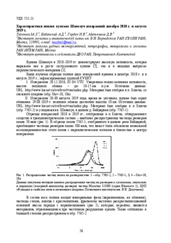
Толстых М.Л., Бабанский А. Д., Горбач Н.В., Мельников Д.В. Характеристики пеплов вулкана Шивелуч извержений декабря 2018 г. и августа 2019 г. // Вулканизм и связанные с ним процессы. Материалы XXIII ежегодной научной конференции, посвящённой Дню вулканолога, 2020. Петропавловск-Камчатский: ИВиС ДВО РАН. 2020. С. 56-59.
Фирстов П.П., Акбашев Р.Р., Макаров Е.О., Котенко Т.А., Будилов Д.И., Лобачева М.А. Комплексный мониторинг извержения вулкана Эбеко (о. Парамушир, Россия) в конце 2018 г. – начале 2019 г. // Вестник КРАУНЦ. Серия: Науки о Земле. 2020. Вып. 45. № 1. С. 89-99. doi: 10.31431/1816-5524-2020-1-45-89-99.
Аннотация
Представлены результаты комплексных геофизических наблюдений за активностью вулкана Эбеко в конце 2018 г. и начале 2019 г. Пункт наблюдений располагался на сейсмической станции «Северо-Курильск» на удалении 7.2 км от кратера вулкана. Выделены три типа отклика в вертикальной составляющей электрического поля атмосферы во время прохождения эруптивных облаков от эксплозий вулкана Эбеко, что свидетельствует о различном механизме их возникновения. Регистрация инфразвуковых акустических сигналов в ближней зоне позволила сделать оценку тротилового эквивалента для наиболее сильных эксплозий, которая составила не более 100 кг тринитротолуола. Обнаружены определенные закономерности в динамике объемной активности радона, связанные с вариациями метеорологических величин и гидрологическими особенностями пункта регистрации. Длительный период активности, близость пункта наблюдений к кратеру дают основание говорить, что вулкан Эбеко представляет собой природную лабораторию для изучения механизма извержений.
Фирстов П.П., Котенко Т.А., Акбашев Р.Р. Усиление эксплозивной активности вулкана Эбеко в апреле–июне 2020 г. // Вестник КРАУНЦ. Серия: Науки о Земле. 2020. Вып. 46. № 2. С. 10-15. doi: 10.31431/1816-5524-2020-2-46-10-15.
Аннотация
В настоящем сообщении на основе совместных наблюдений, проводимых ИВиС ДВО РАН и КФ ФИЦ ЕГС РАН, приводятся результаты наблюдений за активизацией вулкана в апреле–мае 2020 г.
Хубаева О.Р., Бергаль-Кувикас О.В., Сидоров М.Д. Идентификация разрывных нарушений северной части о. Парамушир (Курильские острова, Россия) и их взаимосвязь с гидротермально-магматическими системами: 3D моделирование тектонической раздробленности // Геотектоника. 2020. № 6. С. 77-90. doi: 10.31857/S0016853X20060077.
Черкашин Р.И., Иванов В.В., Озеров А.Ю., Мельников Д.В., Демянчук Ю.В. Активность вулкана Ключевской в ноябре 2019 – июне 2020 гг. // Вестник КРАУНЦ. Серия: Науки о Земле. 2020. Вып. 46. № 2. С. 5-9. doi: 10.31431/1816-5524-2020-2-46-5-9.
Аннотация
Активность вулкана Ключевской в ноябре 2019 – июне 2020 гг.
Щербаков Ю.Д., Перепелов А.Б., Флеров Г.Б., Пузанков М.Ю., Брянский Н.В. Процессы формирования трахитов и комендитов в составе дифференцированной умеренно-щелочной серии пород Срединного хребта Камчатки // Вулканология и сейсмология. 2020. № 2. С. 17-31. doi:10.31857/S0203030620020066.
Аннотация
Статья посвящена исследованию генетических связей пород K–Na умеренно-щелочной серии, проявленной в строении вулканического центра Белоголовский расположенного в тыловой части Срединного хребта Камчатки. Дифференцированный ряд пород серии включает в себя трахибазальты, трахиандезиты, трахиты, комендитовые трахиты и комендиты. Проведение расчетов баланса масс и редкоэлементного моделирования показало, что кристаллизационная дифференциация является основным процессом эволюции расплавов изученного вулканического центра, при этом основным фракционирующим минералом является полевой шпат. Методом LA-ICP-MS получены редкоэлементные характеристики породообразующих минералов (Fsp, Cpx, Bt, Ap, Ol), рассчитаны коэффициенты “минерал/порода”, что позволило представить модель эволюции расплавов вулканического центра Белоголовский. Установлены генетические связи между трахиандезитами, трахитами, комендитовыми трахитами и комендитами, тогда как трахибазальты и трахиандезиты не обнаруживают прямых генетических связей.
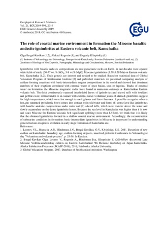
Bergal-Kuvikas Olga, Rogozin Aleksei, Kliapitskiy Evgeniy The role of coastal marine environment in formation the Miocene basaltic andesite ignimbrites at Eastern volcanic belt, Kamchatka // Geophysical Research Abstracts, EGU2019-594. 2019. Vol. 21.
Bindeman I.N., Leonov V.L., Colon D.P., Rogozin Aleksei, Shipley N.K., Jicha B.R., Loewen M.W., Gerya T.V. Isotopic and Petrologic Investigation, and a Thermomechanical Model of Genesis of Large-Volume Rhyolites in Arc Environments: Karymshina Volcanic Complex, Kamchatka, Russia // Frontiers in Earth Science. 2019. Vol. 6. № 238. doi: 10.3389/feart.2018.00238.
Аннотация
The Kamchatka Peninsula of eastern Russia is currently one of the most volcanically active areas on Earth where a combination of > 8 cm/yr subduction convergence rate and thick continental crust generates large silicic magma chambers, reflected by abundant large calderas and caldera complexes. This study examines the largest center of silicic 4-0.5 Ma Karymshina Volcanic Complex, which includes the 25 × 15 km Karymshina caldera, the largest in Kamchatka. A series of rhyolitic tuff eruptions at 4 Ma were followed by the main eruption at 1.78 Ma and produced an estimated 800 km3 of rhyolitic ignimbrites followed by high-silica rhyolitic post-caldera extrusions. The postcaldera domes trace the 1.78 Ma right fracture and form a continuous compositional series with ignimbrites. We here present results of a geologic, petrologic, and isotopic study of the Karymshina eruptive complex, and present new Ar-Ar ages, and isotopic values of rocks for the oldest pre- 1.78 Ma caldera ignimbrites and intrusions, which include a diversity of compositions from basalts to rhyolites. Temporal trends in δ18O, 87Sr/86Sr, and 144Nd/143Nd indicate values comparable to neighboring volcanoes, increase in homogeneity, and temporal increase in mantle-derived Sr and Nd with increasing differentiation over the last 4 million years. Data are consistent with a batholithic scale magma chamber formed by primarily fractional crystallization of mantle derived composition and assimilation of Cretaceous and younger crust, driven by basaltic volcanism and mantle delaminations. All rocks have 35–45% quartz, plagioclase, biotite, and amphibole phenocrysts. Rhyolite-MELTS crystallization models favor shallow (2 kbar) differentiation conditions and varying quantities of assimilated amphibolite partial melt and hydrothermally-altered silicic rock. Thermomechanical modeling with a typical 0.001 km3/yr eruption rate of hydrous basalt into a 38 km Kamchatkan arc crust produces two magma bodies, one near the Moho and the other engulfing the entire section of upper crust. Rising basalts are trapped in the lower portion of an upper crustal magma body, which exists in a partially molten to solid state. Differentiation products of basalt periodically mix with the resident magma diluting its crustal isotopic signatures. At the end of the magmatism crust is thickened by 8 km. Thermomechanical modeling show that the most likely way to generate large spikes of rhyolitic magmatism is through delamination of cumulates and mantle lithosphere after many millions of years of crustal thickening. The paper also presents a chemical dataset for Pacific ashes from ODDP 882 and 883 and compares them to Karymshina ignimbrites and two other Pleistocene calderas studied by us in earlier works.
Girina O.A., Manevich A.G., Melnikov D.V., Nuzhdaev A.A., Petrova E.G. The 2016 Eruptions in Kamchatka and on the North Kuril Islands: The Hazard to Aviation // Journal of Volcanology and Seismology. 2019. Vol. 13. № 3. P. 157-171. https://doi.org/10.1134/S0742046319030047.
Аннотация
Large explosive eruptions of volcanoes pose the highest hazard to modern jet f lights, because such eruptions can eject as much as several cubic kilometers of volcanic ash and aerosol into the atmosphere during a few hours or days. The year 2016 saw eruptions on 5 of the 30 active Kamchatka volcanoes (Sheveluch, Klyuchevskoy, Bezymianny, Karymsky, and Zhupanovsky) and on 3 of the 6 active volcanoes that exist on the North Kuril Islands (Alaid, Ebeko, and Chikurachki). Effusive activity was observed on Sheveluch, Klyuchevskoy, Bezymianny, and Alaid. All volcanoes showed explosive activity. The large explosive events mostly occurred from September through December (Sheveluch), a moderate ash emission accompanied the entire Klyuchevskoy eruption in March–November, and explosive activity of Karymsky, Zhupanovsky, Alaid, and Chikurachki was mostly observed in the earlie r half of the year. The ash ejected in 2016 covered a total area of 600 000 km2, with 460 000 km2 of this being due to Kamchatka volcanoes and 140 000 km2 to the eruptions of the North Kuril volcanoes. The activity of Sheveluch, Klyuchevskoy, and Zhupanovsky was dangerous to international and local f lights, because the explosions sent ash to heights of 10–12 km above sea level, while the eruptions of Bezymianny, Karymsky, Alaid, Ebeko, and Chikurachki were dangerous for local flights, since the ash did not rise higher than 5 km above sea level.