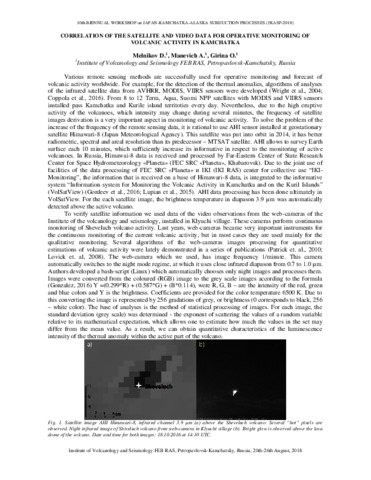
Melnikov D.V., Manevich A.G., Girina O.A. Correlation of the satellite and video data for operative monitoring of volcanic activity in Kamchatka // JKASP-2018. Petropavlovsk-Kamchatsky: IVS FEB RAS. 2018.
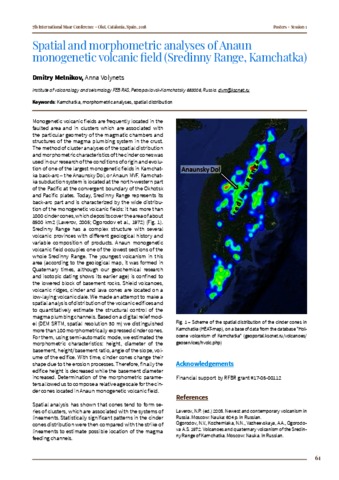
Melnikov D.V., Volynets Anna Spatial and morphometric analyses of Anaun monogenetic volcanic field (Sredinny Range, Kamchatka) // 7th International Maar Conference, Olot, Catalonia, Spain. 2018. P. 61
Аннотация
Monogenetic volcanic fields are frequently located in the faulted area and in clusters which are associated with the particular geometry of the magmatic chambers and structures of the magma plumbing system in the crust. The method of cluster analyses of the spatial distribution and morphometric characteristics of the cinder cones was used in our research of the conditions of origin and evolution of one of the largest monogenetic fields in Kamchat-ka back-arc-the Anaunsky Dol, or Anaun MVF. Kamchat-ka subduction system is located at the northwestern part of the Pacific at the convergent boundary of the Okhotsk and Pacific plates. Today, Sredinny Range represents its back-arc part and is characterized by the wide distribution of the monogenetic volcanic fields: it has more than 1000 cinder cones, which deposits cover the area of about 8500 km2 (Laverov, 2005; Ogorodov et al., 1972) (Fig. 1). Sredinny Range has a complex structure with several volcanic provinces with different geological history and variable composition of products. Anaun monogenetic volcanic field occupies one of the lowest sections of the whole Sredinny Range. The youngest volcanism in this area (according to the geological map, it was formed in Quaternary times, although our geochemical research and isotopic dating shows its earlier age) is confined to the lowered block of basement rocks. Shield volcanoes, volcanic ridges, cinder and lava cones are located on a low-laying volcanic dale. We made an attempt to make a spatial analysis of distribution of the volcanic edifices and to quantitatively estimate the structural control of the magma plumbing channels. Based on a digital relief model (DEM SRTM, spatial resolution 30 m) we distinguished more than 100 morphometrically expressed cinder cones. For them, using semi-automatic mode, we estimated the morphometric characteristics: height, diameter of the basement, height/basement ratio, angle of the slope, volume of the edifice. With time, cinder cones change their shape due to the erosion processes. Therefore, finally the edifice height is decreased while the basement diameter increased. Determination of the morphometric parameters allowed us to compose a relative age scale for the cinder cones located in Anaun monogenetic volcanic field. Spatial analysis has shown that cones tend to form series of clusters, which are associated with the systems of lineaments. Statistically significant patterns in the cinder cones distribution were then compared with the strike of lineaments to estimate possible location of the magma feeding channels.
Romanova I.M., Girina O.A. Spatial Data Infrastructure for information support of volcanological investigations // 10th Biennual workshop on Japan-Kamchatka-Alaska subduction processes (JKASP-2018). Petropavlovsk-Kamchatsky, Russia, August 20-26. // 10th Biennual workshop on Japan-Kamchatka-Alaska subduction processes (JKASP-2018). Petropavlovsk-Kamchatsky: IVS FEB RAS. 2018. P. 193-195.
Taran Yuri, Zelenski Mikhail, Chaplygin Ilya, Malik Natalia, Campion Robin, Inguaggiato Salvatore, Pokrovsky Boris, Kalacheva Elena, Melnikov Dmitry, Kazahaya Ryunosuke, Fischer Tobias Gas Emissions From Volcanoes of the Kuril Island Arc (NW Pacific): Geochemistry and Fluxes // Geochemistry, Geophysics, Geosystems. 2018. Vol. 19. Vol. 6. P. 1859-1880. doi: 10.1029/2018GC007477.
Аннотация
The Kuril Island arc extending for about 1,200 km from Kamchatka Peninsula to Hokkaido Island is a typical active subduction zone with ∼40 historically active subaerial volcanoes, some of which are persistently degassing. Seven Kurilian volcanoes (Ebeko, Sinarka, Kuntomintar, Chirinkotan, Pallas, Berg, and Kudryavy) on six islands (Paramushir, Shiashkotan, Chirinkotan, Ketoy, Urup, and Iturup) emit into the atmosphere > 90% of the total fumarolic gas of the arc. During the field campaigns in 2015–2017 direct sampling of fumaroles, MultiGas measurements of the fumarolic plumes and DOAS remote determinations of the SO2 flux were conducted on these volcanoes. Maximal temperatures of the fumaroles in 2015–2016 were 510°C (Ebeko), 440°C (Sinarka), 260°C (Kuntomintar), 720°C (Pallas), and 820°C (Kudryavy). The total SO2 flux (in metric tons per day) from fumarolic fields of the studied volcanoes was measured as ∼1,800 ± 300 t/d, and the CO2 flux is estimated as 1,250 ± 400 t/d. Geochemical characteristics of the sampled gases include δD and δ18O of fumarolic condensates, δ13C of CO2, δ34S of the total sulfur, ratios 3He/4He and 40Ar/36Ar, concentrations of the major gas species, and trace elements in the volcanic gas condensates. The mole ratios C/S are generally <1. All volcanoes of the arc, except the southernmost Mendeleev and Golovnin volcanoes on Kunashir Island, emit gases with 3He/4He values of >7RA (where RA is the atmospheric 3He/4He). The highest 3He/4He ratios of 8.3RA were measured in fumaroles of the Pallas volcano (Ketoy Island) in the middle of the arc.
Аникин Л.П., Силаев В.И., Чубаров В.М., Петровский В. А., Вергасова Л.П., Карпов Г.А., Сокоренко А.В., Овсянников А.А., Максимов А.П. Алмаз и другие акцессорные минералы в продуктах извержения 2008—2009 гг. Корякского вулкана (Камчатка) // Вестник ИГ Коми НЦ УрО РАН. 2018. № 2. С. 18-27. doi: 10.19110/2221-1381-2018-2-18-27.
Аннотация
В статье приведены новые данные об акцессорных минералах в пеплах, образовавшихся при фреатическом извержении вулкана Корякский в 2008—2009 гг. Охарактеризованы формы выделения, состав и свойства гранатов, корунда и дельталюмита, муассанита, сульфидов таллия, самородных металлических и углеродных фаз, включая алмаз, а также предположительно абиогенных конденсированных органических соединений. Особенностью корякских алмазов является очень мелкий размер и кубический габитус, что может свидетельствовать об их кристаллизации из газовой фазы в условиях значительных пересыщений по углероду. Обнаружения в пеплах на Корякском вулкане разнообразных по форме и цвету частиц и нитей конденсированных органических соединений подтверждает ранее сделанный вывод о систематическом неорганическом синтезе на современных вулканах достаточно высокоорганизованных предбиологических форм органического вещества.
Арсанова Г.И. О природе вулканической деятельности (Опыт использования принципов синергетического мировидения) / Сб. Система «Планета Земля». 200 лет со дня кончины М.Б. Барклая-де-Толли (1761-1818). М.: ЛЕНАНД. 2018. С. 37-63.
Изучено строение подводного вулканического массива Рикорда, состоящего из четырех сливающихся по основанию вулканических построек, и имеющего, скорее всего, четвертичный возраст. На начальных этапах жизни вулканического массива изливались базальтовые и андезибазальтовые лавы. Высокие значения естественной остаточной намагниченности драгированных пород обусловлены большим содержанием однодоменных и псевдооднодоменных зерен титаномагнетита и магнетита. Установлены направления подводящих каналов и наличие периферических магматических очагов. Построена объемная модель центральной части вулканического массива Рикорда, в которой выделено десять крупных магнитовозмущающих блоков, которые, вероятнее всего, являются застывшими субвертикальными подводящими каналами.
Волынец А.О., Певзнер М.М., Толстых М.Л., Баранский А.Д. Вулканизм южной части Срединного хребта Камчатки в неоген-четвертичное время // Геология и геофизика. 2018. Т. 59. № 12. С. 1979-1996. doi:10.15372/GiG20181204.
Аннотация
Анализ геохимических характеристик миоцен-четвертичных вулканитов Срединного хребта Камчатки позволил выделить в его пределах несколько различных провинций: северную и южную части хребта, а внутри последней дополнительно «восточную», «западную» и «центральную» ветви. Приведены новые данные по составу неоген-четвертичных вулканических пород южной части Срединного хребта Камчатки: вулканическим массивам Хангар, Ичинский, горы Юртиная в «западной» ветви хребта, вулканическим проявлениям Быстринского и Козыревского хребта в «восточной» ветви, а также Анаунскому долу и массиву Уксичан. Показано, что наблюдаются систематические отличия в составах пород «западной» и «восточной» ветвей. В пределах «восточной» ветви в неогене проявлен вулканизм островодужного типа. В четвертичное время в геохимических характеристиках вулканитов этого района сочетаются признаки островодужного и внутриплитного происхождения. Такой геохимический тип авторы предлагают называть гибридным. В пределах «западной» ветви вулканизм гибридного типа проявляется начиная с неогена, а типично островодужные вулканиты не обнаружены. Процессы магмогенерации в «западной» ветви Cрединного хребта в значительной степени подвержены влиянию мантийного источника обогащенного типа; участие флюида здесь ощущается в меньшей степени, чем в породах «восточной» ветви, где явно прослеживается субдукционный компонент источника.
Гирина О.А. О действующих вулканах Камчатки и их изучении // "Заповедная Россия": материалы библиотечных чтений. Петропавловск-Камчатский: КГБУ Камчатская краевая детская библиотека им.В. Кручины. 2018. С. 5-14.
Гирина О.А., Гордеев Е.И., Маневич А.Г., Мельников Д.В., Нуждаев А.А., Романова И.М. Камчатской группе реагирования на вулканические извержения (KVERT) – 25 лет // Вулканизм и связанные с ним процессы. Материалы региональной конференции, посвященной Дню вулканолога, 29-30 марта 2018 г. Петропавловск-Камчатский: ИВиС ДВО РАН. 2018. С. 24-27.