Гирина О.А., Ладыгин В.М. Эруптивная активность Ключевской группы вулканов Камчатки // IX Всероссийская научная конференция с международным участием «Вулканизм, биосфера и экологические проблемы». Майкоп: Магарин О.Г.. 2018. С. 39-44.
Гирина О.А., Лупян Е.А., Крамарева Л.С., Мельников Д.В., Маневич А.Г., Сорокин А.А., Гордеев Е.И., Уваров И.А., Кашницкий А.В., Бурцев М.А., Марченков В.В., Мазуров А.А., Константинова А.М., Романова И.М., Мальковский С.И., Королев С.П. Информационная система Дистанционный мониторинг активности вулканов Камчатки и Курил (ИС VolSatView): возможности и опыт работы // Шестнадцатая Всероссийская Открытая конференция «Современные проблемы дистанционного зондирования Земли из космоса». М.: ИКИ РАН. 2018. С. 5
Гирина О.А., Лупян Е.А., Мельников Д.В., Маневич А.Г., Сорокин А.А., Крамарева Л.С., Уваров И.А., Кашницкий А.В. Извержение вулкана Безымянный 20 декабря 2017 года // Современные проблемы дистанционного зондирования Земли из космоса. 2018. Т. 15. № 3. С. 88-99. https://doi.org/10.21046/2070-7401-2018-15-3-88-99.
Аннотация
Безымянный — один из наиболее активных вулканов Камчатки и мира. В декабре 2016 г. началась его активизация после четырёхлетнего молчания в течение 2012–2016 гг. В 2017 г. произошло три пароксизмальных эксплозивных извержения вулкана, событию 20 декабря с выносом пепла до 15 км над уровнем моря посвящена эта статья. Описан ход извержения и результаты его анализа, в том числе показано анимированное изображение движения пеплового облака от вулкана, выполненное по серии снимков Himawari-8 (http://dvrcpod.planeta.smislab.ru/animation/1513757110.gif), с наложением на него результатов моделирования распространения пеплового облака (http://dvrcpod.planeta.smislab.ru/animation/1513777733.gif). Эруптивное облако двигалось на северо-восток от вулкана со средней скоростью 100 км/ч. Основная площадь территории, охваченной пепловыми облаками, составляла около 78 000 км2, в том числе на суше — 42 600 км2. Пепловые облака после окончания извержения фиксировались в атмосфере на удалении до 1500–2000 км на северо-востоке от вулкана до 22 декабря 2017 г. Кроме отложений пепла, в результате извержения в долине Восточной и долине р. Сухая Хапица были образованы отложения пирокластических (протяжённостью 5–6 км от вулкана) и грязевых (до 18 км) потоков. Спутниковый мониторинг вулкана и анализ данных по его извержению проводился с помощью информационной системы VolSatView и автоматизированной информационной системы «Сигнал».
Гирина О.А., Лупян Е.А., Сорокин А.А., Мельников Д.В., Маневич А.Г., Маневич Т.М. Спутниковые и наземные наблюдения эксплозивных извержений вулкана Жупановский (Камчатка, Россия) в 2013 и 2014–2016 гг. // Вулканология и сейсмология. 2018. № 1. С. 3-17. https://doi.org/10.7868/S0203030618010017.
Аннотация
Активный андезитовый вулкан Жупановский состоит из четырех слившихся конусов стратовулканов. Исторические эксплозивные извержения в 1940, 1957, 2014–2016 гг. происходили из конуса Приемыш. Недавние извержения Жупановского были изучены с использованием спутниковых данных, полученных из информационной системы “Мониторинг активности вулканов Камчатки и Курил” (VolSatView), а также некоторых видео- и визуальных наблюдений вулкана. Первое извержение Жупановского началось 22 октября и продолжалось до 24 октября 2013 г. Центрами мощного выноса газовых шлейфов, содержащих некоторое количество пепла, были фумаролы, расположенные на западном склоне Приемыша. Новое извержение вулкана началось 6 июня 2014 г. и продолжалось до 20 ноября 2016 г. Эксплозивная активность Жупановского в 2014–2016 гг. была неравномерной, на спутниковых снимках пепловые шлейфы были отмечены примерно 112 дней в течение 17 месяцев. Наиболее активно вулкан работал с июня до октября и в ноябре 2014 г., с января до апреля 2015 г. и в январе–феврале 2016 г., в это время на спутниковых снимках в районе конуса Приемыш почти постоянно отмечалась яркая термальная аномалия. Кульминацией извержения вулкана Жупановский в 2014–2016 гг. были эксплозивные события и обрушения частей конуса Приемыш 12 и 14 июля и 30 ноября 2015 г. и 12 февраля и 20 ноября 2016 г.
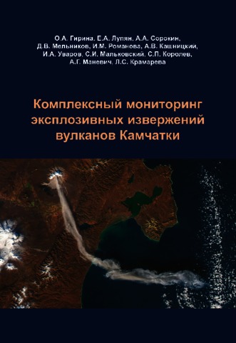
В монографии приведены различные данные о вулканах Камчатки, описаны возможности их изучения на основе комплексного использования методов и технологий дистанционного зондирования, наземных наблюдений и численного моделирования. Значительное внимание уделено вопросам построения и применения информационных систем, обеспечивающих сегодня оперативный мониторинг и исследования вулканической активности, которые в последние годы совместно разрабатываются и развиваются специалистами Института вулканологии и сейсмологии ДВО РАН (Петропавловск-Камчатский), Института космических исследований РАН (Москва), Вычислительного центра ДВО РАН (Хабаровск) и Дальневосточного филиала НИЦ Планета (Хабаровск). Приведены результаты комплексных исследований эксплозивных извержений вулканов, а также потенциальная опасность действующих вулканов Камчатки для населения и авиации, полученные учеными ИВиС ДВО РАН, в том числе, с помощью представленных в монографии новых методов, технологий и систем.
Гирина О.А., Мальковский С.И., Сорокин А.А. Ретроспективный анализ извержения 1964 г. вулкана Шивелуч (Камчатка) с помощью информационной системы VolSatView // Современные проблемы дистанционного зондирования Земли из космоса. Тезисы докладов. Шестнадцатая Всероссийская открытая конференция. 12-16 ноября 2018 г. М.: ИКИ РАН. 2018.
Гирина О.А., Мельников Д.В., Маневич А.Г., Демянчук Ю.В., Нуждаев А.А. Вулкан Безымянный в 2016-2018 гг. по данным KVERT // Вулканизм и связанные с ним процессы. Материалы региональной конференции, посвященной Дню вулканолога, 29-30 марта 2018 г. Петропавловск-Камчатский: ИВиС ДВО РАН. 2018. С. 28-31.
Гирина О.А., Мельников Д.В., Маневич А.Г., Кашницкий А.В., Лупян Е.А., Сорокин А.А., Уваров И.А., Романова И.М., Королев С.П., Мальковский С.И., Нуждаев А.А. Камчатская группа реагирования на вулканические извержения (KVERT) - опыт комплексного мониторинга вулканов Камчатки и Северных Курил в 1993-2018 гг. // "Проблемы прогнозирования чрезвычайных ситуаций". Тезисы доклада XVII Всероссийской научной-практический конференции, 30-31 октября 2018. М.: ФКУ Центр "Антистихия" МЧС России. 2018. С. 29-30.
Гирина О.А., Мельников Д.В., Маневич А.Г., Сорокин А.А., Крамарева Л.С., Уваров И.А., Кашницкий А.В. Анализ активности вулкана Безымянный в 2016-2017 гг. с помощью методов дистанционного зондирования // Современные проблемы дистанционного зондирования Земли из космоса. Тезисы докладов. Шестнадцатая Всероссийская открытая конференция. 12-16 ноября 2018 г. М.: ИКИ РАН. 2018.
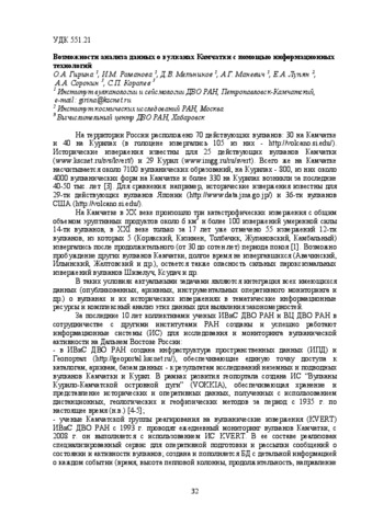
Гирина О.А., Романова И.М., Мельников Д.В., Маневич А.Г., Лупян Е.А., Сорокин А.А., Королев С.П. Возможности анализа данных о вулканах Камчатки с помощью информационных технологий // Вулканизм и связанные с ним процессы. Материалы региональной конференции, посвященной Дню вулканолога, 29-30 марта 2018 г. Петропавловск-Камчатский: ИВиС ДВО РАН. 2018. С. 32-35.