Rheological burst as mechanism of andesitic pyroclastics formation (1995)
Maximov A.P. Rheological burst as mechanism of andesitic pyroclastics formation // IUGG XXI Gener. Assemb.. 1995, Boulder, USA. 1995. P. B411
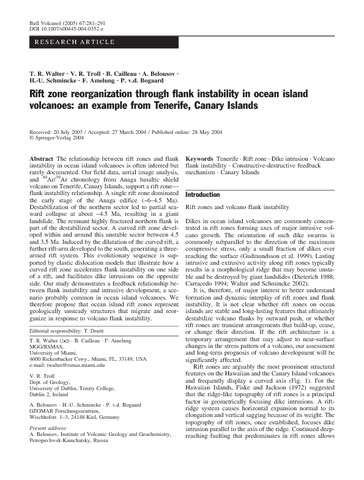
Rift zone reorganization through flank instability in ocean island volcanoes: an example from Tenerife, Canary Islands (2005)
Walter T. R., Troll V. R., Cailleau B., Belousov A., Schmincke H.-U., Amelung F., Bogaard P. Rift zone reorganization through flank instability in ocean island volcanoes: an example from Tenerife, Canary Islands // Bulletin of Volcanology. 2005. Vol. 67. № 4. P. 281-291. doi:10.1007/s00445-004-0352-z.
Rift- and arc-type basaltic volcanism of the Sredinny Ridge, Kamchatka: case study of the Payalpan volcano-tectonic structure (2004)
Ivanov A.V., Perepelov A.B., Puzankov M.Yu., Yasnygina T.A., Malykh Yu.M., Rasskazov S.V. Rift- and arc-type basaltic volcanism of the Sredinny Ridge, Kamchatka: case study of the Payalpan volcano-tectonic structure / Metallogeny of the Pacific Northwest: Tectonics, Magmatism and Metallogeny of Active Continental Margins. Vladavostok: Dalnauka. 2004. P. 345-349.
Аннотация
Trace element data for volcanic rocks of the Payalpan volcano-tectonic structure (Sredinny ridge, Kamchatka) allows distinguishing typical island-arc, rift and transitional series of rocks. Island-arc basaltic and differentiated magmas erupted in the Late Miocene and Pliocene. In the Late Pliocene – Early Pleistocene, there was a voluminous event dominated by the basaltic magmas of rift-type series. This event followed by voluminous eruptions of mainly basaltic andesites of transitional series. At the end of the Pleistocene and probably during the Holocene volume of eruptions diminished and composition of magmas shifted towards rift-type basaltic series. Practically in the same area in the Pleistocene and Holocene the Icha volcano produced basaltic andesite to rhyolite magmas of the island-arc and transitional series. Reasons for spatial overlapping and temporal evolution of the island-arc and rift magma types are also discussed.
Russian eruption warning systems for aviation (2011)
Neal C.A., Girina O.A., Senyukov S.L., Rybin A.V., Osiensky J., Izbekov P., Ferguson G. Russian eruption warning systems for aviation // Materials of ISTC International Workshop “Worldwide early warning system of volcanic activities and mitigation of the global/regional consequences of volcanic eruptions”, Moscow, Russia, July 8-9, 2010. Moscow: ISTC. 2011. P. 29-47.
Russian eruption warning systems for aviation (2009)
Neal C.A., Girina O.A., Senyukov S.L., Rybin A.V., Osiensky J., Izbekov P., Ferguson G. Russian eruption warning systems for aviation // Natural Hazards. 2009. Vol. 51. № 2. P. 245-262. https://doi.org/10.1007/s11069-009-9347-6.
Аннотация
More than 65 potentially active volcanoes on the Kamchatka Peninsula and the Kurile Islands pose a substantial threat to aircraft on the Northern Pacific (NOPAC), Russian Trans-East (RTE), and Pacific Organized Track System (PACOTS) air routes. The Kamchatka Volcanic Eruption Response Team (KVERT) monitors and reports on volcanic hazards to aviation for Kamchatka and the north Kuriles. KVERT scientists utilize real-time seismic data, daily satellite views of the region, real-time video, and pilot and field reports of activity to track and alert the aviation industry of hazardous activity. Most Kurile Island volcanoes are monitored by the Sakhalin Volcanic Eruption Response Team (SVERT) based in Yuzhno-Sakhalinsk. SVERT uses daily moderate resolution imaging spectroradiometer (MODIS) satellite images to look for volcanic activity along this 1,250-km chain of islands. Neither operation is staffed 24 h per day. In addition, the vast majority of Russian volcanoes are not monitored seismically in real-time. Other challenges include multiple time-zones and language differences that hamper communication among volcanologists and meteorologists in the US, Japan, and Russia who share the responsibility to issue official warnings. Rapid, consistent verification of explosive eruptions and determination of cloud heights remain significant technical challenges. Despite these difficulties, in more than a decade of frequent eruptive activity in Kamchatka and the northern Kuriles, no damaging encounters with volcanic ash from Russian eruptions have been recorded.
Satellite and Ground-Based Observations of Explosive Eruptions on Zhupanovsky Volcano, Kamchatka, Russia in 2013 and in 2014–2016 (2018)
Girina O.A., Loupian E.A., Sorokin A.A., Melnikov D.V., Manevich A.G., Manevich T.M Satellite and Ground-Based Observations of Explosive Eruptions on Zhupanovsky Volcano, Kamchatka, Russia in 2013 and in 2014–2016 // Journal of Volcanology and Seismology. 2018. Vol. 12. № 1. P. 1-15. https://doi.org/10.1134/S0742046318010049.
Аннотация
The active andesitic Zhupanovsky Volcano consists of four coalesced stratovolcano cones. The historical explosive eruptions of 1940, 1957, and 2014‒2016 discharged material from the Priemysh Cone. The recent Zhupanovsky eruptions were studied using satellite data supplied by the Monitoring of Active Volcanoes in Kamchatka and on the Kuril Islands information system (VolSatView), as well as based on video and visual observations of the volcano. The first eruption started on October 22 and lasted until October 24, 2013. Fumaroles situated on the Priemysh western slope were the centers that discharged gas plumes charged with some amount of ash. The next eruption started on June 6, 2014 and lasted until November 20, 2016. The explosive activity of Zhupanovsky was not uniform in 2014–2016, with the ash plumes being detected on satellite images for an approximate total duration of 112 days spread over 17 months. The most vigorous activity was observed between June and October, and in November 2014, with a bright thermal anomaly being nearly constantly seen on satellite images around Priemysh between January and April 2015 and in January–February 2016. The 2014–2016 eruption culminated in explosive events and collapse of parts of the Priemysh Cone on July 12 and 14, November 30, 2015, and on February 12 and November 20, 2016.
Satellite data interactive analysis tools in the VolSatView volcanoes monitoring system (2018)
Kashnitskii A.V., Burtsev M.A., Girina O.A., Loupian E.A., Zlatopolsky A. Satellite data interactive analysis tools in the VolSatView volcanoes monitoring system // JKASP-2018. Petropavlovsk-Kamchatsky: IVS FEB RAS. 2018.
Satellite monitoring of the Kamchatkan active volcanoes (2014)
Girina O.A., Melnikov D.V., Manevich A.G., Nuzhdaev A.A. Satellite monitoring of the Kamchatkan active volcanoes // Modern Information Technologies in Earth Sciences. Proceedings of the International Conference, Petropavlovsk-Kamchatsky, September 8-13, 2014. Vladivostok: Dalnauka. 2014. P. 51-52.
Satellite observations and numerical simulation results for the comprehensive analysis of ash clouds transport during the explosive eruptions of Kamchatka volcanoes (2017)
Sorokin A.A., Girina O.A., Loupian E.A., Malkovskii S.I., Balashov I.V., Efremov V.Yu., Kramareva L.S., Korolev S.P., Romanova I.M., Simonenko E.V. Satellite observations and numerical simulation results for the comprehensive analysis of ash clouds transport during the explosive eruptions of Kamchatka volcanoes // Russian Meteorology and Hydrology. 2017. Vol. 42. № 12. P. 759-765. doi: 10.3103/S1068373917120032.
Аннотация
Ash clouds resulting from explosive volcanic eruptions pose a real threat to human (for aircraft flights, airports operations, etc.); therefore, the detection, monitoring, and forecast of their movement is an urgent and important issue. The features and examples of application of the new tool developed on the basis of "Monitoring of active volcanoes of Kamchatka and the Kurile Islands" information system (VolSatView) are described. It allows the integrated monitoring and forecasting of ash cloud transport using the data of remote sensing and mathematical modeling as well as the assessment of the parameters of explosive events.
Scenario of the 1996 volcanic tsunamis in Karymskoye Lake, Kamchatka, inferred from X-ray tomography of heavy minerals in tsunami deposits (2018)
Falvard S., Paris R., Belousova M., Belousov A., Giachetti T., Cuven S. Scenario of the 1996 volcanic tsunamis in Karymskoye Lake, Kamchatka, inferred from X-ray tomography of heavy minerals in tsunami deposits // Marine Geology. 2018. № 396. P. 160-170.