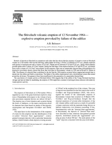
The Shiveluch volcanic eruption of 12 November 1964 — explosive eruption provoked by failure of the edifice (1995)
Belousov A.B. The Shiveluch volcanic eruption of 12 November 1964 — explosive eruption provoked by failure of the edifice // Journal of Volcanology and Geothermal Research. 1995. Vol. 66. № 1-4. P. 357-365. doi:10.1016/0377-0273(94)00072-O.
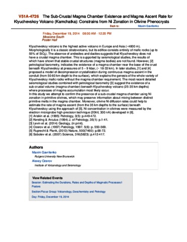
The Sub-Crustal Magma Chamber Existence and Magma Ascent Rate for Klyuchevskoy Volcano (Kamchatka): Constrains from Ni Zonation in Olivine Phenocrysts (2014)
Gavrilenko M., Ozerov A. The Sub-Crustal Magma Chamber Existence and Magma Ascent Rate for Klyuchevskoy Volcano (Kamchatka): Constrains from Ni Zonation in Olivine Phenocrysts // Abstract V51A-4726 presented at 2014 Fall Meeting, AGU, San Francisco, Calif., 15-19 Dec.. 2014.
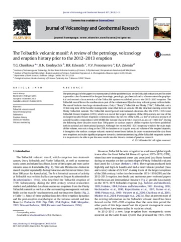
The Tolbachik volcanic massif: A review of the petrology, volcanology and eruption history prior to the 2012–2013 eruption (2015)
Churikova T.G., Gordeychik B.N., Edwards B.R., Ponomareva V.V., Zelenin E.A. The Tolbachik volcanic massif: A review of the petrology, volcanology and eruption history prior to the 2012–2013 eruption // Journal of Volcanology and Geothermal Research. 2015. Vol. 307. P. 3 - 21. doi: 10.1016/j.jvolgeores.2015.10.016.
Аннотация
The primary goal of this paper is to summarize all of the published data on the Tolbachik volcanic massif in order to provide a clear framework for the geochronologic, petrologic, geochemical and to a lesser extent the geophysical and tectonic characteristics of the Tolbachik system established prior to the 2012–2013 eruption. The Tolbachik massif forms the southwestern part of the voluminous Klyuchevskoy volcanic group in Kamchatka. The massif includes two large stratovolcanoes, Ostry (“Sharp”) Tolbachik and Plosky (“Flat”) Tolbachik, and a 70 km long zone of the basaltic monogenetic cones that form an arcuate rift-like structure running across the Plosky Tolbachik summit. The Tolbachik massif gained international attention after the 1975–1976 Great Tolbachik Fissure Eruption (GTFE), which was one of the largest eruptions of the 20th century and one of the six largest basaltic fissure eruptions in historical time. By the end of the GTFE, 2.2 km3 of volcanic products of variable basaltic compositions with MORB-like isotopic characteristics covered an area of > 1000 km2. During the following three decades more than 700 papers on various aspects of this eruption have been published both in national and international journals. Although the recent 2012–2013 eruption, which is the main topic of this volume, was not as long as the {GTFE} in duration or as large in area and volume of the erupted deposits, it brought to the surface a unique volcanic material never found before. In order to understand the data from new eruptions and make significant progress towards a better understanding of the Tolbachik magmatic system it is important to be able to put the new results into the historic context of previous research.
The VolSatView for Satellite Monitoring and Kamchatkan Volcanoes Study (2018)
Girina O.A., Loupian E.A., Efremov V.Yu., Melnikov D.V., Manevich A.G., Gordeev E.I., Sorokin A.A., Kramareva L.S., Uvarov I.A., Kashnitskii A.V., Burtsev M.A. The VolSatView for Satellite Monitoring and Kamchatkan Volcanoes Study // AGU Abstracts. Washington D.C.: 2018. № 358489.
Аннотация
Annually, from 3 to 6 Kamchatkan volcanoes produce eruptions, during which the explosions eject ash to 10-15 km a.s.l., and ash clouds spread thousands of kilometers from volcanoes. Ash clouds pose a serious threat to the modern jet aviation. Scientists of KVERT have conduct daily monitoring of Kamchatka volcanoes since 1993, to mitigate volcanic hazards to airline operations and population. Since 2014, satellite monitoring of volcanoes they carried out with the VolSatView (Remote monitoring of active volcanoes of Kamchatka and the Kuril Islands) (http://volcanoes.smislab.ru) IS. The system utilize all the available satellite data, weather and video observations to ensure continues monitoring and study of volcanic activity in Kamchatka. The VolSatView work with distributed information resources and computation systems. This work was supported by the Russian Science Foundation, project No. 16-17-00042.
The VolSatView information system for Monitoring the Volcanic Activity in Kamchatka and on the Kuril Islands (2016)
Gordeev E.I., Girina O.A., Lupyan E.A., Sorokin A.A., Kramareva L.S., Efremov V.Yu., Kashnitskii A.V., Uvarov I.A., Burtsev M.A., Romanova I.M., Mel’nikov D.V., Manevich A.G., Korolev S.P., Verkhoturov A.L. The VolSatView information system for Monitoring the Volcanic Activity in Kamchatka and on the Kuril Islands // Journal of Volcanology and Seismology. 2016. Vol. 10. № 6. P. 382-394. https://doi.org/10.1134/S074204631606004X.
Аннотация
Kamchatka and the Kuril Islands are home to 36 active volcanoes with yearly explosive eruptions that eject ash to heights of 8 to 15 km above sea level, posing hazards to jet planes. In order to reduce the risk of planes colliding with ash clouds in the north Pacific, the KVERT team affiliated with the Institute of Volcanology and Seismology of the Far East Branch of the Russian Academy of Sciences (IV&S FEB RAS) has conducted daily satellite-based monitoring of Kamchatka volcanoes since 2002. Specialists at the IV&S FEB RAS, Space Research Institute of the Russian Academy of Sciences (SRI RAS), the Computing Center of the Far East Branch of the Russian Academy of Sciences (CC FEB RAS), and the Far East Planeta Center of Space Hydrometeorology Research (FEPC SHR) have developed, introduced into practice, and were continuing to refine the VolSatView information system for Monitoring of Volcanic Activity in Kamchatka and on the Kuril Islands during the 2011–2015 period. This system enables integrated processing of various satellite data, as well as of weather and land-based information for continuous monitoring and investigation of volcanic activity in the Kuril–Kamchatka region. No other information system worldwide offers the abilities that the Vol-SatView has for studies of volcanoes. This paper shows the main abilities of the application of VolSatView for routine monitoring and retrospective analysis of volcanic activity in Kamchatka and on the Kuril Islands.
The active volcanoes of Kamchatka and Paramushir Island, North Kurils in 2007 (2009)
Girina O.A., Ushakov S.V., Malik N.A., Manevich A.G., Melnikov D.V., Nuzhdaev A.A., Demyanchuk Yu.V., Kotenko L.V. The active volcanoes of Kamchatka and Paramushir Island, North Kurils in 2007 // Journal of Volcanology and Seismology. 2009. Vol. 3. № 1. P. 1-17. https://doi.org/10.1134/S0742046309010011.
Аннотация
Eight strong eruptions of four Kamchatka volcanoes (Bezymyannyi, Klyuchevskoi, Shiveluch, and Karymskii) and Chikurachki Volcano on Paramushir Island, North Kurils took place in 2007. In addition, an explosive event occurred on Mutnovskii Volcano and increased fumarole activity was recorded on Avacha and Gorelyi volcanoes in Kamchatka and Ebeko Volcano on Paramushir Island, North Kurils. Thanks to close cooperation with colleagues involved in the Kamchatkan Volcanic Eruption Response Team (KVERT) project from the Elizovo Airport Meteorological Center and volcanic ash advisory centers in Tokyo, Anchorage, and Washington (Tokyo VAAC, Anchorage VAAC, and Washington VAAC), all necessary precautions were taken for flight safety near Kamchatka.
The ages of calderas, large explosive craters and active volcanoes in the Kuril-Kamchatka region, Russia (1995)
Braitseva O.A., Melekestsev I.V., Ponomareva V.V., Sulerzhitskii L.D. The ages of calderas, large explosive craters and active volcanoes in the Kuril-Kamchatka region, Russia // Bulletin of Volcanology. 1995. Vol. 57. № 6. P. 383-402. doi: 10.1007/BF00300984.
Аннотация
The ages of most of calderas, large explosive craters and active volcanoes in the Kuril-Kamchatka region have been determined by extensive geological, geomorphological, tephrochronological and isotopic geochronological studies, including more than 600 14C dates. Eight ‘Krakatoa-type’ and three ‘Hawaiian-type’ calderas and no less than three large explosive craters formed here during the Holocene. Most of the Late Pleistocene Krakatoa-type calderas were established around 30 000–40 000 years ago. The active volcanoes are geologically very young, with maximum ages of about 40 000–50 000 years. The overwhelming majority of recently active volcanic cones originated at the very end of the Late Pleistocene or in the Holocene. These studies show that all Holocene stratovolcanoes in Kamchatka were emplaced in the Holocene only in the Eastern volcanic belt. Periods of synchronous, intensified Holocene volcanic activity occurred within the time intervals of 7500–7800 and 1300–1800 14C years BP.
The caldera-forming eruption of Ksudach volcano about cal. A.D. 240: the greatest explosive event of our era in Kamchatka, Russia (1996)
Braitseva O.A., Melekestsev I.V., Ponomareva V.V., Kirianov V.Yu. The caldera-forming eruption of Ksudach volcano about cal. A.D. 240: the greatest explosive event of our era in Kamchatka, Russia // Journal of Volcanology and Geothermal Research. 1996. Vol. 70. № 1-2. P. 49-65. doi:10.1016/0377-0273(95)00047-X.
Аннотация
The largest Plinian eruption of our era and the latest caldera-forming eruption in the Kuril-Kamchatka region occurred about cal. A.D. 240 from the Ksudach volcano. This catastrophic explosive eruption was similar in type and characteristics to the 1883 Krakatau event. The volume of material ejected was 18–19 km3 (8 km3 DRE), including 15 km3 of tephra fall and 3–4 km3 of pyroclastic flows. The estimated height of eruptive column is 22–30 km. A collapse caldera resulting from this eruption was 4 × 6.5 km in size with a cavity volume of 6.5–7 km3. Tephra fall was deposited to the north of the volcano and reached more than 1000 km. Pyroclastic flows accompanied by ash-cloud pyroclastic surges extended out to 20 km. The eruption was initially phreatomagmatic and then became rhythmic, with each pulse evolving from pumice falls to pyroclastic flows. Erupted products were dominantly rhyodacite throughout the eruption. During the post-caldera stage, when the Shtyubel cone started to form within the caldera, basaltic-andesite and andesite magma began to effuse. The trigger for the eruption may have been an intrusion of mafic magma into the rhyodacite reservoir. The eruption had substantial environmental impact and may have produced a large acidity peak in the Greenland ice sheet.